MyTopo
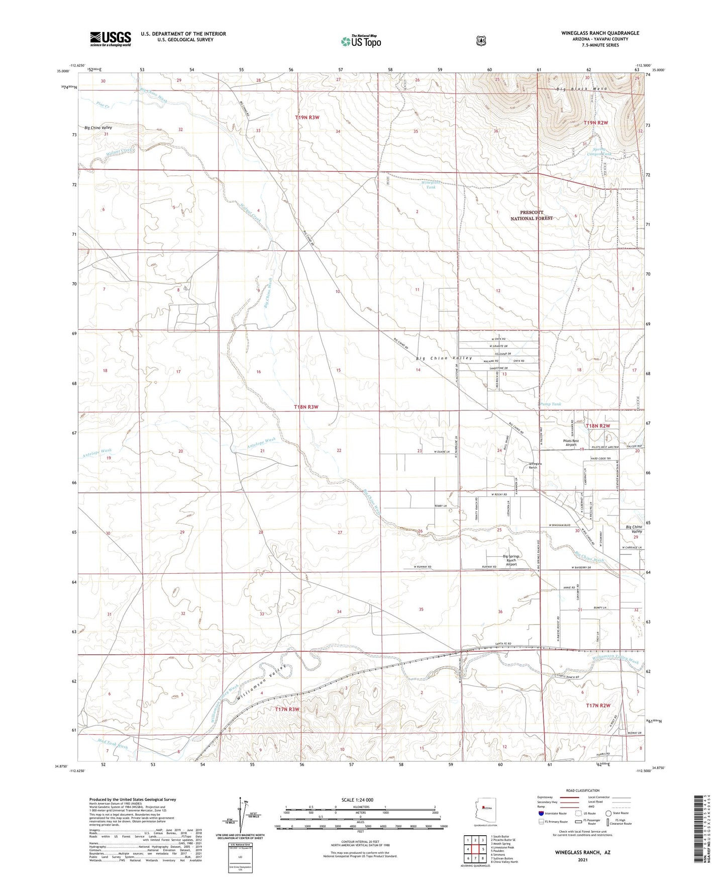
Wineglass Ranch Arizona US Topo Map
Couldn't load pickup availability
Also explore the Wineglass Ranch Forest Service Topo of this same quad for updated USFS data
2021 topographic map quadrangle Wineglass Ranch in the state of Arizona. Scale: 1:24000. Based on the newly updated USGS 7.5' US Topo map series, this map is in the following counties: Yavapai. The map contains contour data, water features, and other items you are used to seeing on USGS maps, but also has updated roads and other features. This is the next generation of topographic maps. Printed on high-quality waterproof paper with UV fade-resistant inks.
Quads adjacent to this one:
West: Limestone Peak
Northwest: South Butte
North: Picacho Butte SE
Northeast: Meath Spring
East: Paulden
Southeast: Chino Valley North
South: Sullivan Buttes
Southwest: Simmons
This map covers the same area as the classic USGS quad with code o34112h5.
Contains the following named places: AGF Trick Tank, Antelope Wash, Big Springs Ranch Airport, Eddie Well, Eddy Place, Kayfour Railroad Station, Mud Tank Wash, Pilots Rest Airport, Pine Creek, Pump Tank, Spring Canyon Tank, Walnut Creek, Williamson Valley, Wineglass Ranch, Wineglass Tank, ZIP Code: 86334