
MyTopo
Piute Point Arizona US Topo Map
Couldn't load pickup availability
Also explore the Piute Point Forest Service Topo of this same quad for updated USFS data
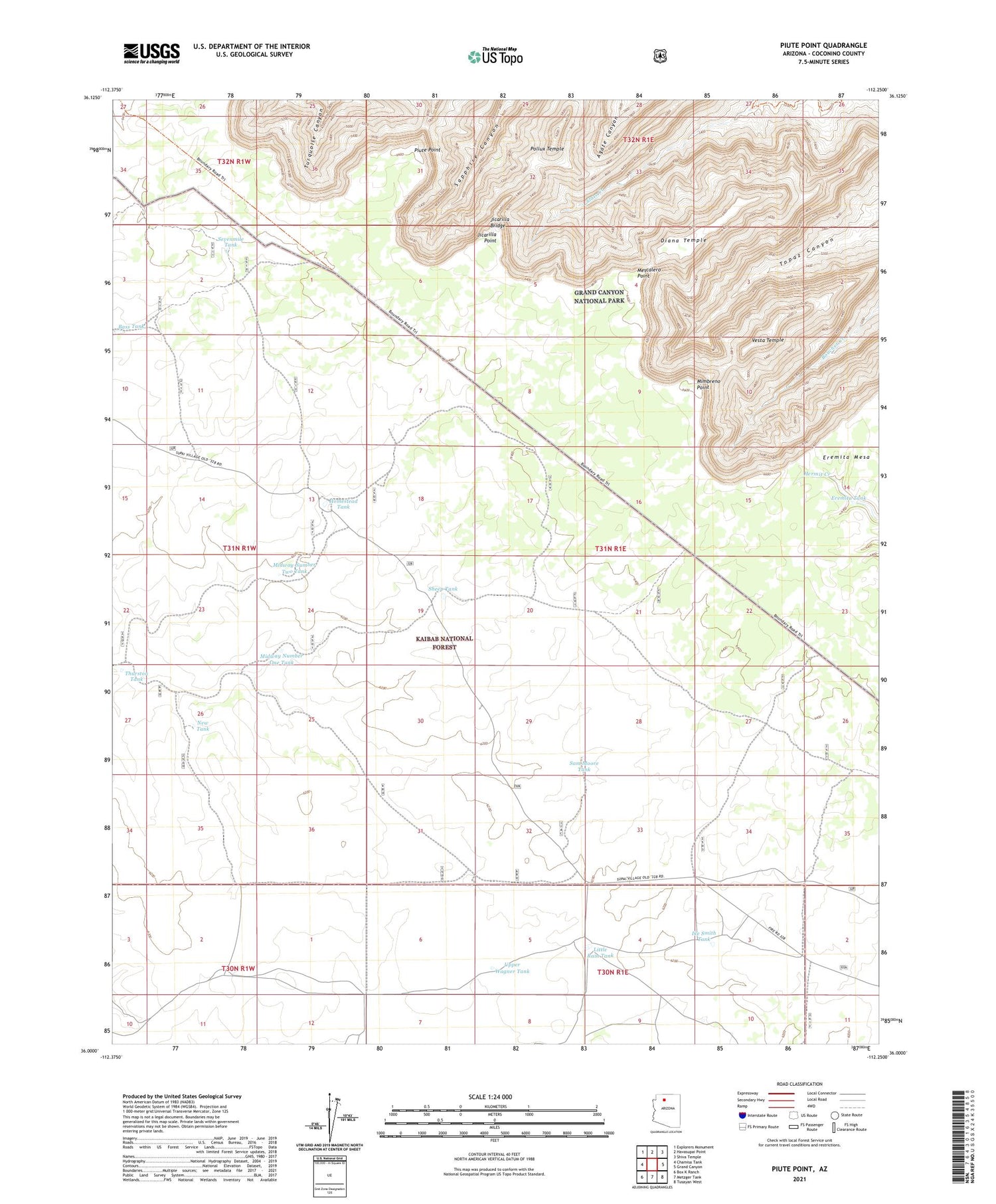
2021 topographic map quadrangle Piute Point in the state of Arizona. Scale: 1:24000. Based on the newly updated USGS 7.5' US Topo map series, this map is in the following counties: Coconino. The map contains contour data, water features, and other items you are used to seeing on USGS maps, but also has updated roads and other features. This is the next generation of topographic maps. Printed on high-quality waterproof paper with UV fade-resistant inks.
Quads adjacent to this one:
West: Chamisa Tank
Northwest: Explorers Monument
North: Havasupai Point
Northeast: Shiva Temple
East: Grand Canyon
Southeast: Tusayan West
South: Metzger Tank
Southwest: Box K Ranch
This map covers the same area as the classic USGS quad with code o36112a3.
Contains the following named places: Bass Tank, Diana Temple, Eremita Tank, Homestead Tank, Ike Smith Tank, Jicarilla Bridge, Jicarilla Point, Little Rain Tank, Mescalero Point, Midway Number One Tank, Midway Number Two Tank, Mimbreno Point, New Tank, Piute Point, Pollux Temple, Sam Moore Tank, Sevenmile Tank, Sheep Tank, The Ranch Airport, Thurston Tank, Upper Wagner Tank, Vesta Temple


