
MyTopo
Explorers Monument Arizona US Topo Map
Couldn't load pickup availability
Also explore the Explorers Monument Forest Service Topo of this same quad for updated USFS data
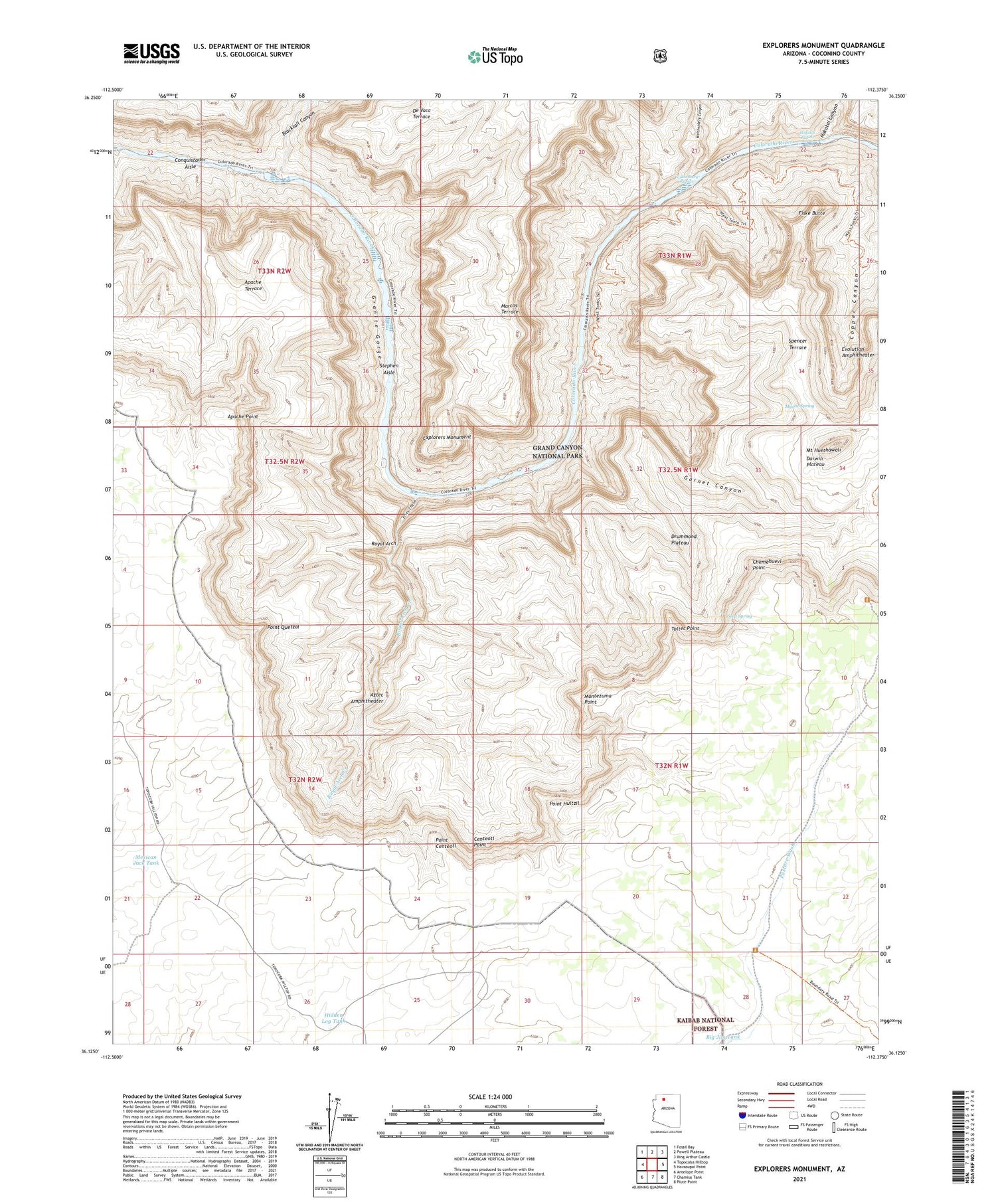
2021 topographic map quadrangle Explorers Monument in the state of Arizona. Scale: 1:24000. Based on the newly updated USGS 7.5' US Topo map series, this map is in the following counties: Coconino. The map contains contour data, water features, and other items you are used to seeing on USGS maps, but also has updated roads and other features. This is the next generation of topographic maps. Printed on high-quality waterproof paper with UV fade-resistant inks.
Quads adjacent to this one:
West: Topocoba Hilltop
Northwest: Fossil Bay
North: Powell Plateau
Northeast: King Arthur Castle
East: Havasupai Point
Southeast: Piute Point
South: Chamisa Tank
Southwest: Antelope Point
This map covers the same area as the classic USGS quad with code o36112b4.
Contains the following named places: Apache Point, Apache Terrace, Aztec Amphitheater, Big Jim Tank, Blacktail Canyon, Centeotl Point, Chemehuevi Point, Conquistador Aisle, Darwin Plateau, De Vaca Terrace, Drummond Plateau, Elves Chasm, Evolution Amphitheater, Explorers Monument, Fiske Butte, Garnet Canyon, Granite Gorge, Hakatai Canyon, Hakatai Rapids, Hidden Log Tank, Hundred and Twenty Mile Creek, Marcos Terrace, Mexican Jack Tank, Montezuma Point, Mount Huethawali, Mystic Spring, Pasture Wash Ranger Station, Point Centeotl, Point Huitzil, Point Quetzal, Royal Arch, Royal Arch Creek, Seep Spring, Spencer Terrace, Stephen Aisle, Toltec Point, Walthenberg Canyon, Walthenberg Rapids


