
MyTopo
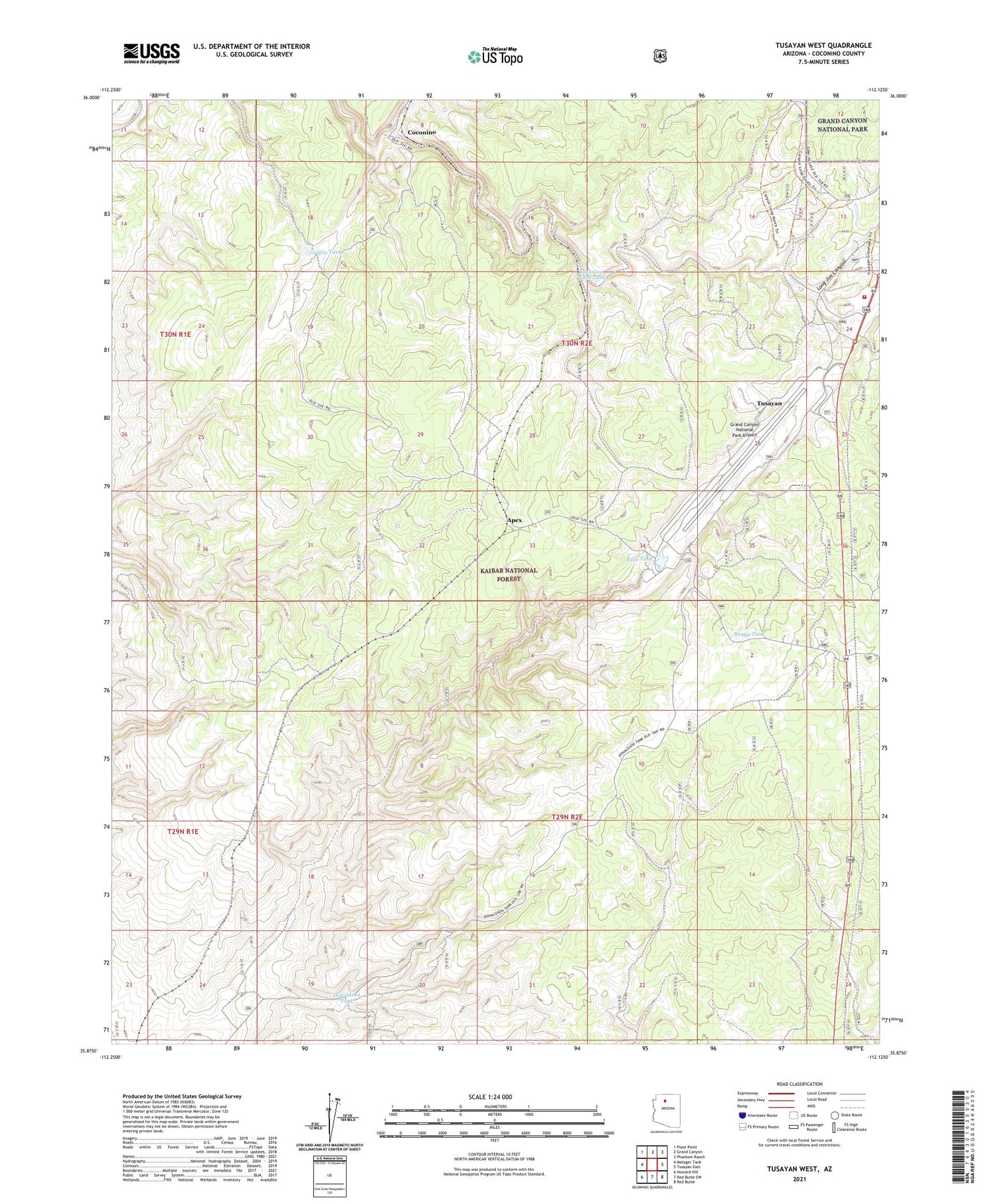
Tusayan West Arizona US Topo Map
Couldn't load pickup availability
Also explore the Tusayan West Forest Service Topo of this same quad for updated USFS data
2021 topographic map quadrangle Tusayan West in the state of Arizona. Scale: 1:24000. Based on the newly updated USGS 7.5' US Topo map series, this map is in the following counties: Coconino. The map contains contour data, water features, and other items you are used to seeing on USGS maps, but also has updated roads and other features. This is the next generation of topographic maps. Printed on high-quality waterproof paper with UV fade-resistant inks.
Quads adjacent to this one:
West: Metzger Tank
Northwest: Piute Point
North: Grand Canyon
Northeast: Phantom Ranch
East: Tusayan East
Southeast: Red Butte
South: Red Butte SW
Southwest: Howard Hill
This map covers the same area as the classic USGS quad with code o35112h2.
Contains the following named places: Apex, Apex Trick Tank, Boggy Tank, Boggy Trick Tank, Coconino, Coconino Railroad Station, Coconino Wash Tank, Donaldson Tank, Game Tank, Grand Canyon National Park Airport, Griffin Tank, Kaibab National Forest, KRBZ-FM (Tusayan), Long Jim Canyon, Madison Aviation Airport, Madison Aviation Heliport, Moqui Rifle Range, Rain Tank, Randall Water Tank, Ranger Tank, South Grand Canyon Sanitary District Tusayan Wastewater Reclamation Facility, Ten X Family Picnic Ground, Tusayan, Tusayan Airport, Tusayan Census Designated Place, Tusayan Fire Department, Tusayan Heliport


