MyTopo
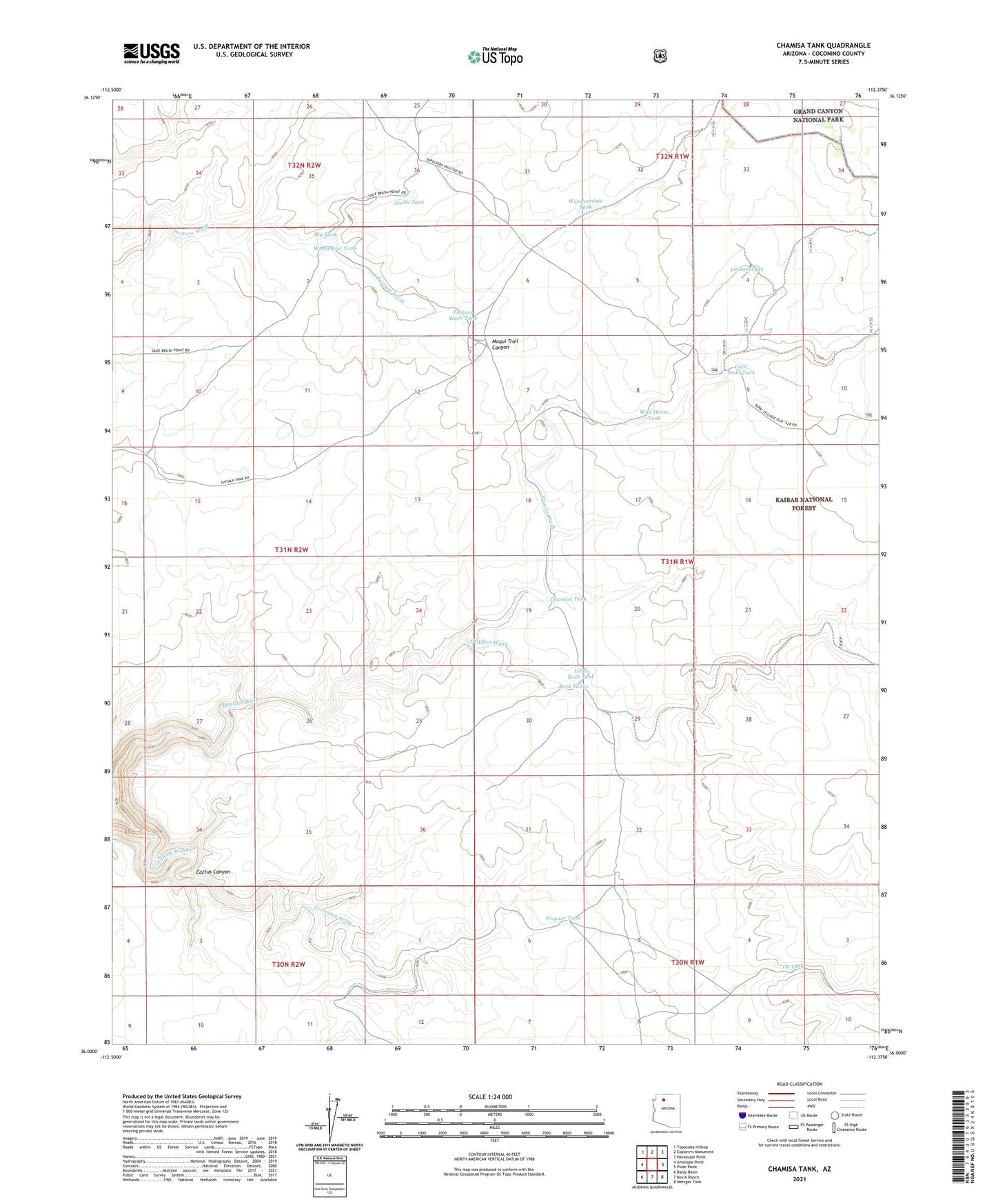
Chamisa Tank Arizona US Topo Map
Couldn't load pickup availability
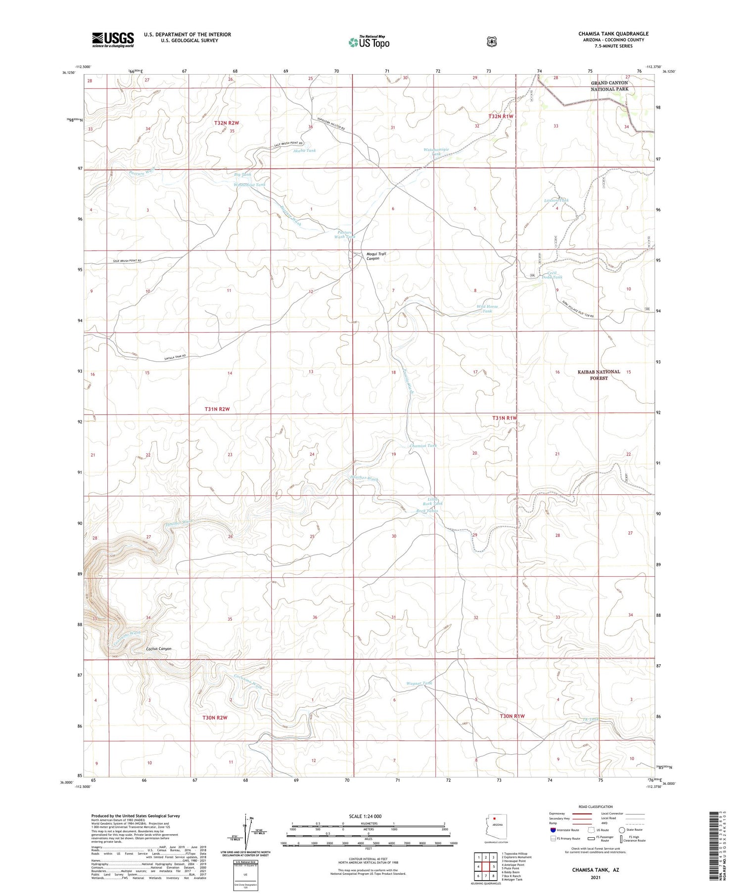
Also explore the Chamisa Tank Forest Service Topo of this same quad for updated USFS data
2021 topographic map quadrangle Chamisa Tank in the state of Arizona. Scale: 1:24000. Based on the newly updated USGS 7.5' US Topo map series, this map is in the following counties: Coconino. The map contains contour data, water features, and other items you are used to seeing on USGS maps, but also has updated roads and other features. This is the next generation of topographic maps. Printed on high-quality waterproof paper with UV fade-resistant inks.
Quads adjacent to this one:
West: Antelope Point
Northwest: Topocoba Hilltop
North: Explorers Monument
Northeast: Havasupai Point
East: Piute Point
Southeast: Metzger Tank
South: Box K Ranch
Southwest: Baldy Basin
This map covers the same area as the classic USGS quad with code o36112a4.
Contains the following named places: Akaba Tank, Big Tank, Cecil Dodd Tank, Chamisa Tank, Coconino Wash, Lauzon Tank, Lauzon Trick Tank, Little Rock Tank, Nagiller Tank, Pasture Wash Tank, Prairie Wash, Rock Tanks, TK Tank, Wagner Tank, Washedout Tank, Watahomigie Tank, Wild Horse Tank