MyTopo
Rawhide Mountain Arizona US Topo Map
Couldn't load pickup availability
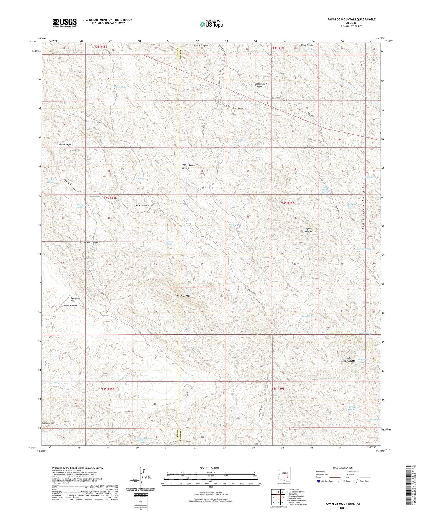
2023 topographic map quadrangle Rawhide Mountain in the state of Arizona. Scale: 1:24000. Based on the newly updated USGS 7.5' US Topo map series, this map is in the following counties: Graham, Pinal. The map contains contour data, water features, and other items you are used to seeing on USGS maps, but also has updated roads and other features. This is the next generation of topographic maps. Printed on high-quality waterproof paper with UV fade-resistant inks.
Quads adjacent to this one:
West: Jerusalem Mountain
Northwest: Coolidge Dam
North: San Carlos Reservoir
Northeast: Dewey Flat
East: Mount Turnbull
Southeast: Cobre Grande Mountain
South: Booger Canyon
Southwest: Brandenburg Mountain
This map covers the same area as the classic USGS quad with code o33110a4.
Contains the following named places: Ash Spring, Beargrass Flat, Bowman Ranch, Brushy Spring, Buck Canyon, Coal Field Windmill, Copper Reef Mine, Copper Reef Mountain, Davis Spring, Double Troughs Spring, Dry Camp Spring, Elderberry Spring, Friend Mine, Garden Creek, Horse Basin Tanks, Janis Canyon, Janis Spring, Lime Tank, Little Stanley Butte, Musk Hog Spring, Old Ranch Spring, Pinon Spring, Rawhide Mountain, Red Rooster Spring, Sanders Rangeline Cabin, Squaw Spring, Sycamore Spring, U B Rangeline Cabin, Water Canyon, Webster Spring, Willow Spring