MyTopo
San Carlos Reservoir Arizona US Topo Map
Couldn't load pickup availability
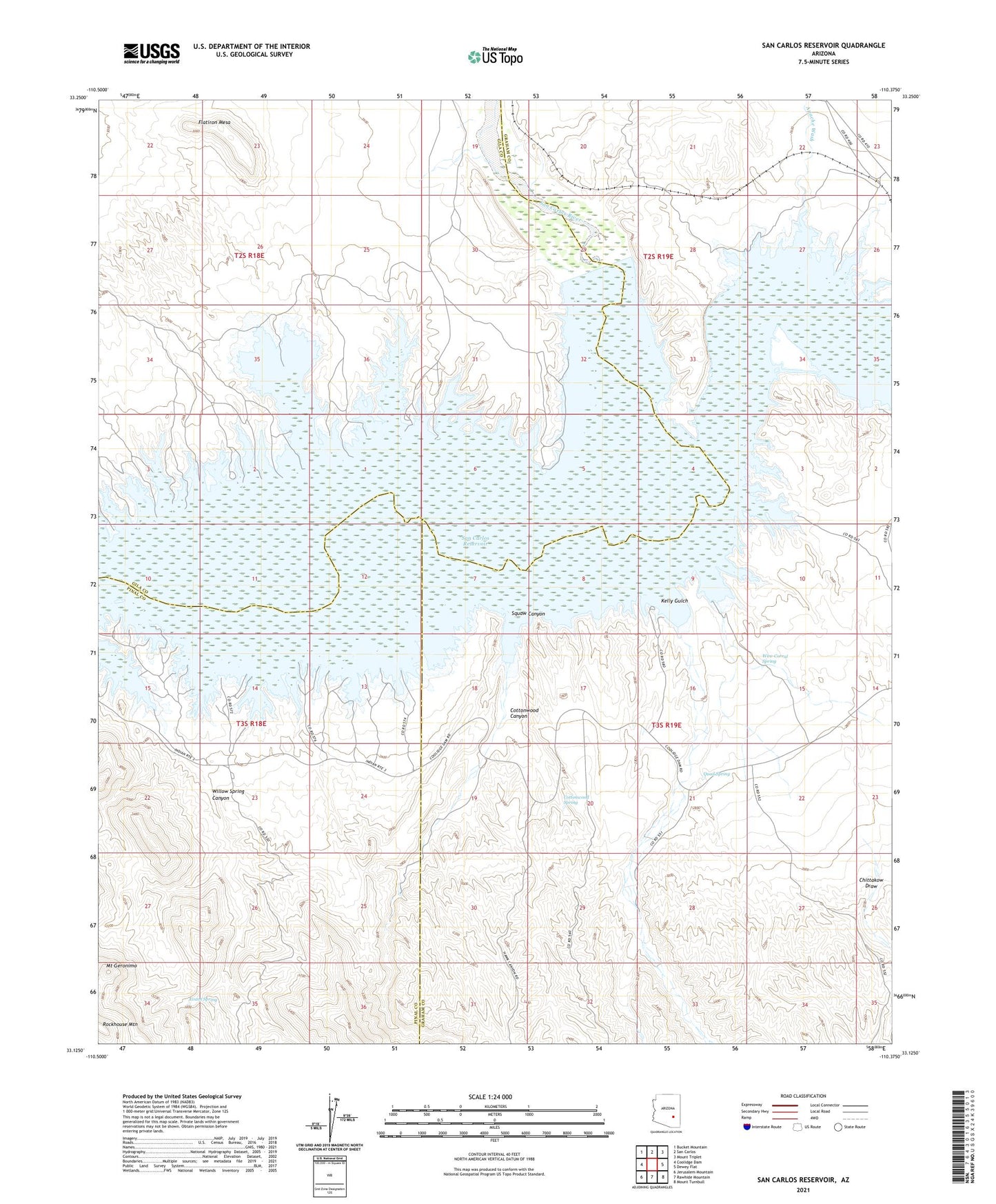
2023 topographic map quadrangle San Carlos Reservoir in the state of Arizona. Scale: 1:24000. Based on the newly updated USGS 7.5' US Topo map series, this map is in the following counties: Graham, Gila, Pinal. The map contains contour data, water features, and other items you are used to seeing on USGS maps, but also has updated roads and other features. This is the next generation of topographic maps. Printed on high-quality waterproof paper with UV fade-resistant inks.
Quads adjacent to this one:
West: Coolidge Dam
Northwest: Bucket Mountain
North: San Carlos
Northeast: Mount Triplet
East: Dewey Flat
Southeast: Mount Turnbull
South: Rawhide Mountain
Southwest: Jerusalem Mountain
This map covers the same area as the classic USGS quad with code o33110b4.
Contains the following named places: Apache Wash, Chittakow Draw, Cottonwood Canyon, Cottonwood Spring, Evans Spring, Flatiron Mesa, Kelly Gulch, Mount Geronimo, Quail Spring, San Carlos, San Carlos Reservoir, San Carlos River, Squaw Canyon, Squaw Canyon Well, Starlight Well, Willow Spring Canyon, Wire-Corral Spring