MyTopo
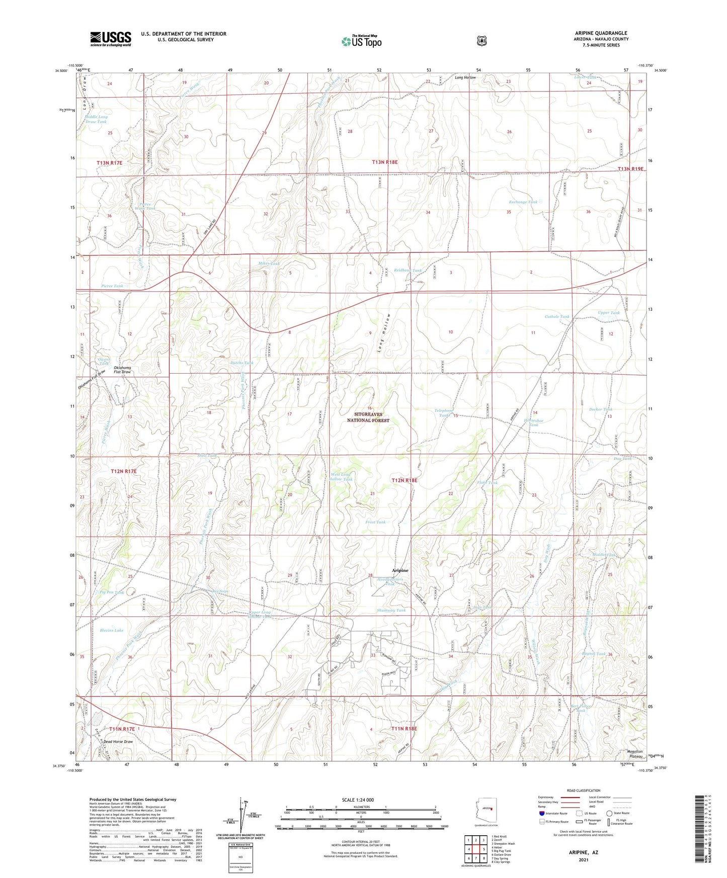
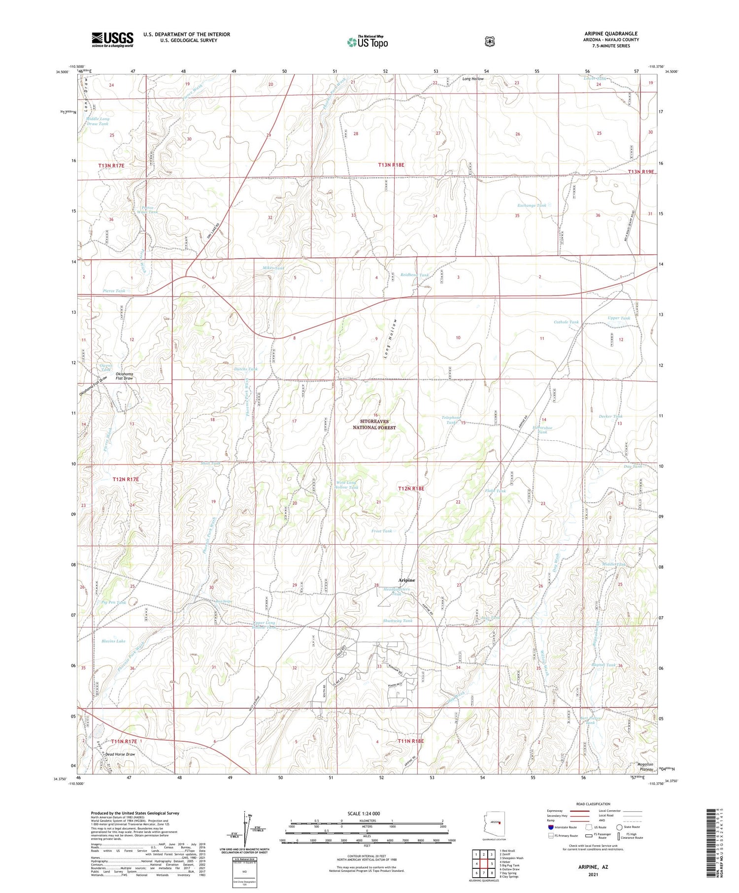
Aripine Arizona US Topo Map
Couldn't load pickup availability
Also explore the Aripine Forest Service Topo of this same quad for updated USFS data
2021 topographic map quadrangle Aripine in the state of Arizona. Scale: 1:24000. Based on the newly updated USGS 7.5' US Topo map series, this map is in the following counties: Navajo. The map contains contour data, water features, and other items you are used to seeing on USGS maps, but also has updated roads and other features. This is the next generation of topographic maps. Printed on high-quality waterproof paper with UV fade-resistant inks.
Quads adjacent to this one:
West: Heber
Northwest: Red Knoll
North: Zeniff
Northeast: Sheepskin Wash
East: Big Pug Tank
Southeast: Clay Springs
South: Day Spring
Southwest: Outlaw Draw
This map covers the same area as the classic USGS quad with code o34110d4.
Contains the following named places: Aripine, Bagnal Tank, Bagnal Wash, Bert Pierce Tank, Blevins Lake, Blevins Ranch, Cathole Tank, Day Tank, Dead Horse Draw, Decker Ranch, Decker Tank, Dutchs Tank, Exchange Tank, Flake Ranch, Flake Tank, Frost Tank, Halter Cross Ranch, Headquarters Tank, Horseshoe Tank, Jays Tank, LDS Ranch, Long Hollow, Lower Tank, Middle Long Draw Tank, Middle Tank, Mikes Tank, Oklahoma Flat Draw, Owens Tank, Park Tank, Park Well, Pierce Tank, Pierce Wash Tank, Pig Pen Tank, Reidhead Tank, Rice Seeps, Shell Tank, Shumway Tank, Sundown Girls Ranch, Telephone Tank, Upper Long Hollow Tank, Upper Tank, West Long Hollow Tank, Willow Wash