MyTopo
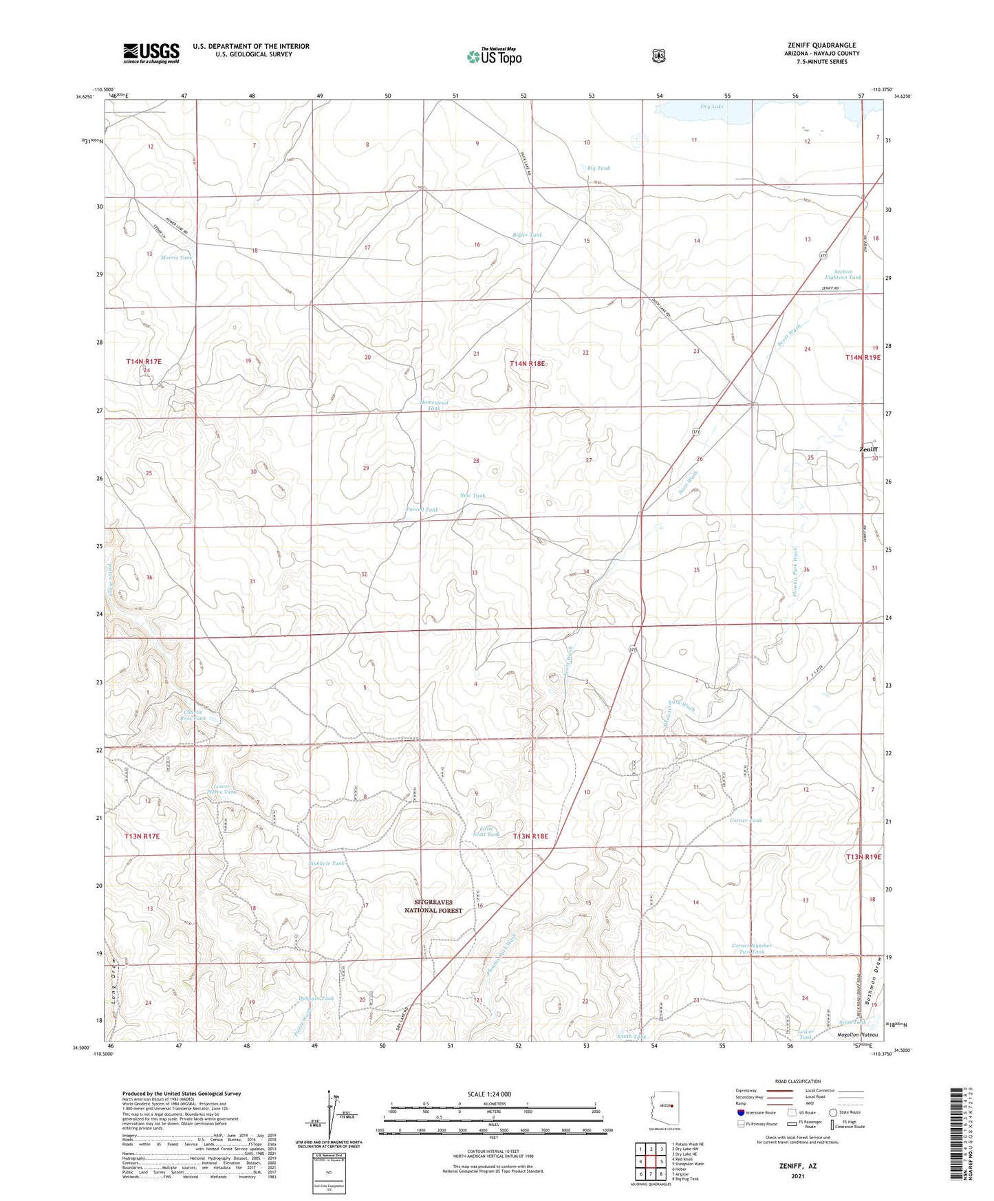
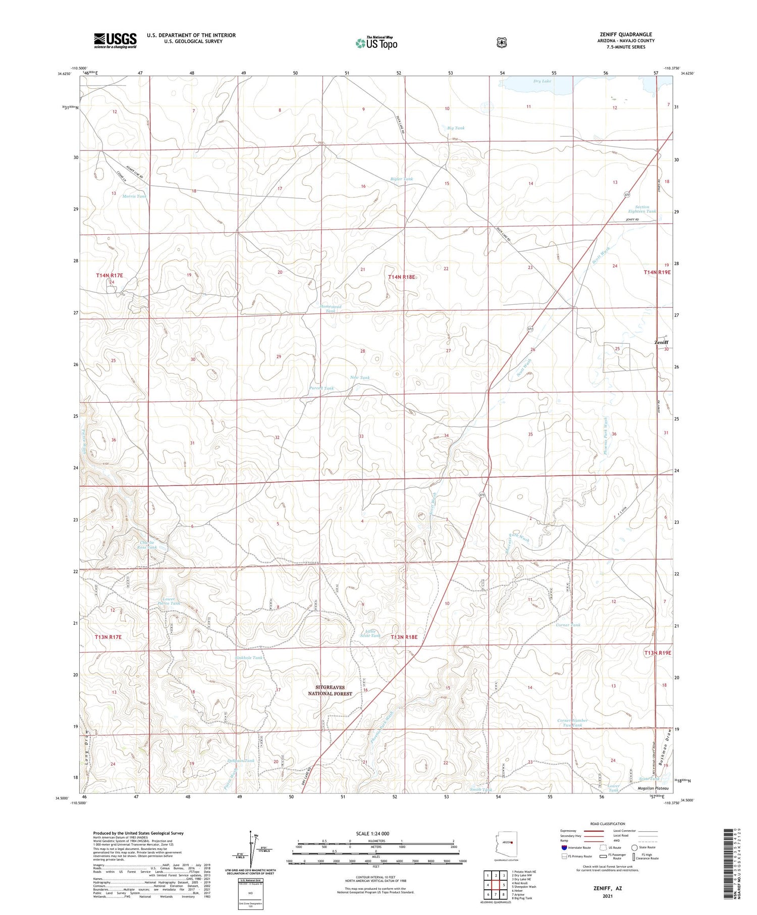
Zeniff Arizona US Topo Map
Couldn't load pickup availability
Also explore the Zeniff Forest Service Topo of this same quad for updated USFS data
2021 topographic map quadrangle Zeniff in the state of Arizona. Scale: 1:24000. Based on the newly updated USGS 7.5' US Topo map series, this map is in the following counties: Navajo. The map contains contour data, water features, and other items you are used to seeing on USGS maps, but also has updated roads and other features. This is the next generation of topographic maps. Printed on high-quality waterproof paper with UV fade-resistant inks.
Quads adjacent to this one:
West: Red Knoll
Northwest: Potato Wash NE
North: Dry Lake NW
Northeast: Dry Lake NE
East: Sheepskin Wash
Southeast: Big Pug Tank
South: Aripine
Southwest: Heber
This map covers the same area as the classic USGS quad with code o34110e4.
Contains the following named places: Big Tank, Bigler Tank, Charlie Ross Tank, Corner Number Two Tank, Corner Tank, Decker Wash, DeSpain Tank, Homestead Tank, Little Scott Tank, Lower Pierce Tank, Morris Tank, New Tank, Purcell Tank, Scott Tank, Scott Wash, Scott Well, Section Eighteen Tank, Sinkhole Tank, Smith Tank, Zeniff