MyTopo
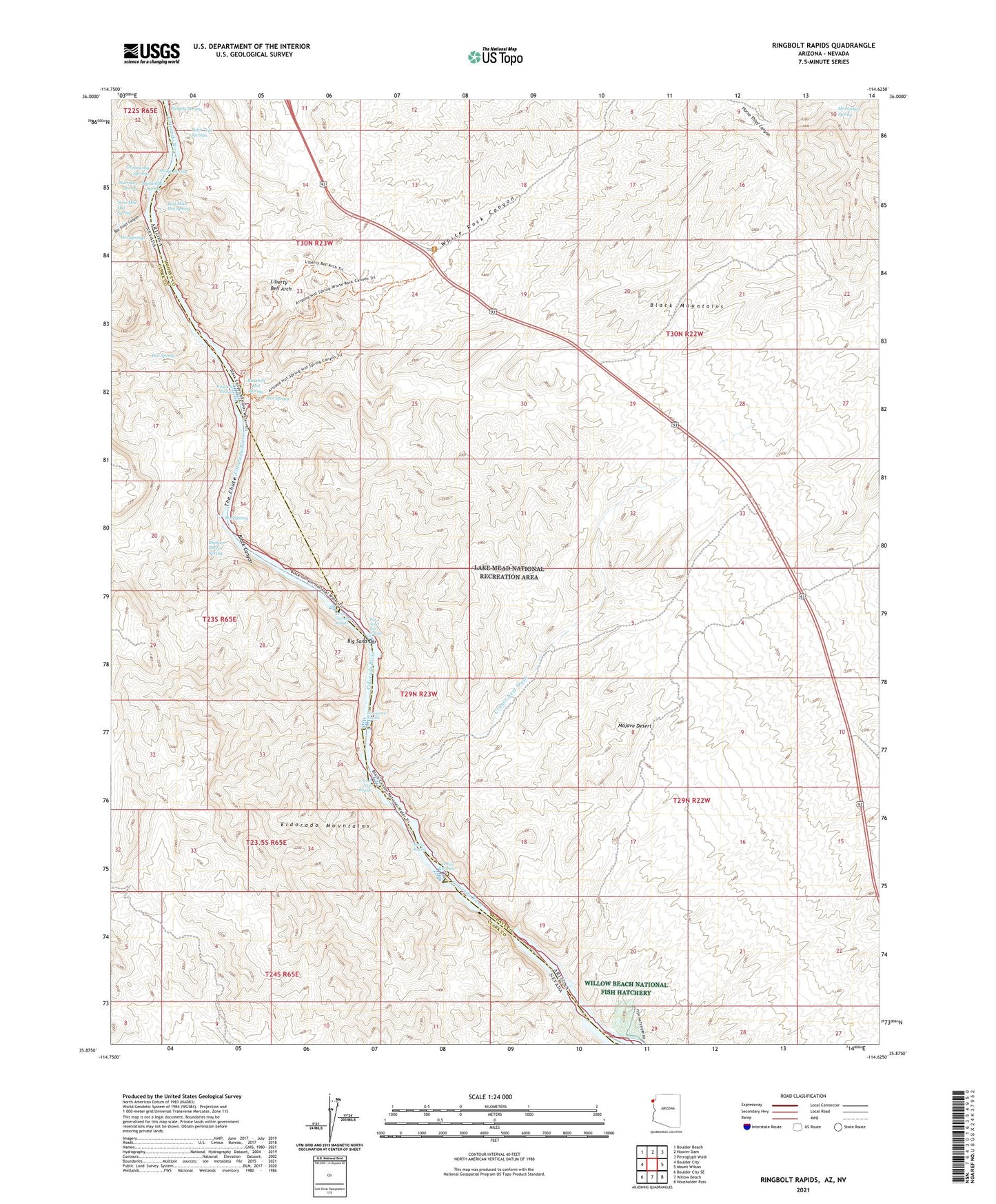
Ringbolt Rapids Arizona US Topo Map
Couldn't load pickup availability
2021 topographic map quadrangle Ringbolt Rapids in the states of Arizona, Nevada. Scale: 1:24000. Based on the newly updated USGS 7.5' US Topo map series, this map is in the following counties: Mohave, Clark. The map contains contour data, water features, and other items you are used to seeing on USGS maps, but also has updated roads and other features. This is the next generation of topographic maps. Printed on high-quality waterproof paper with UV fade-resistant inks.
Quads adjacent to this one:
West: Boulder City
Northwest: Boulder Beach
North: Hoover Dam
Northeast: Petroglyph Wash
East: Mount Wilson
Southeast: Housholder Pass
South: Willow Beach
Southwest: Boulder City SE
Contains the following named places: Big Sand Bar, Big Sand Bar Rapids, Bighorn Sheep Spring, Black Canyon Wilderness, Boy Scout Canyon, Cranes Nest Rapids, Cranes Nest Wash, Cross Current Rapids, Horseshoe Rapids, Horsethief Spring, Hot Spring, Hot Springs, Indian Rapids, Liberty Bell Arch, Lost Man Hot Spring, Maidenhair Spring, Narrows Spring, Nebula Spring, Palm Tree Springs, Ringbolt Hot Spring, Ringbolt Rapids, Rocky Rapids, Stomp Spring, The Chute, Two Mile Hot Spring, White Rock Canyon, Willow Beach National Fish Hatchery