MyTopo
Round Mountain Arizona US Topo Map
Couldn't load pickup availability
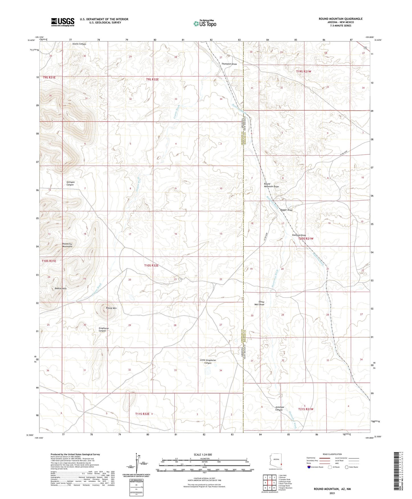
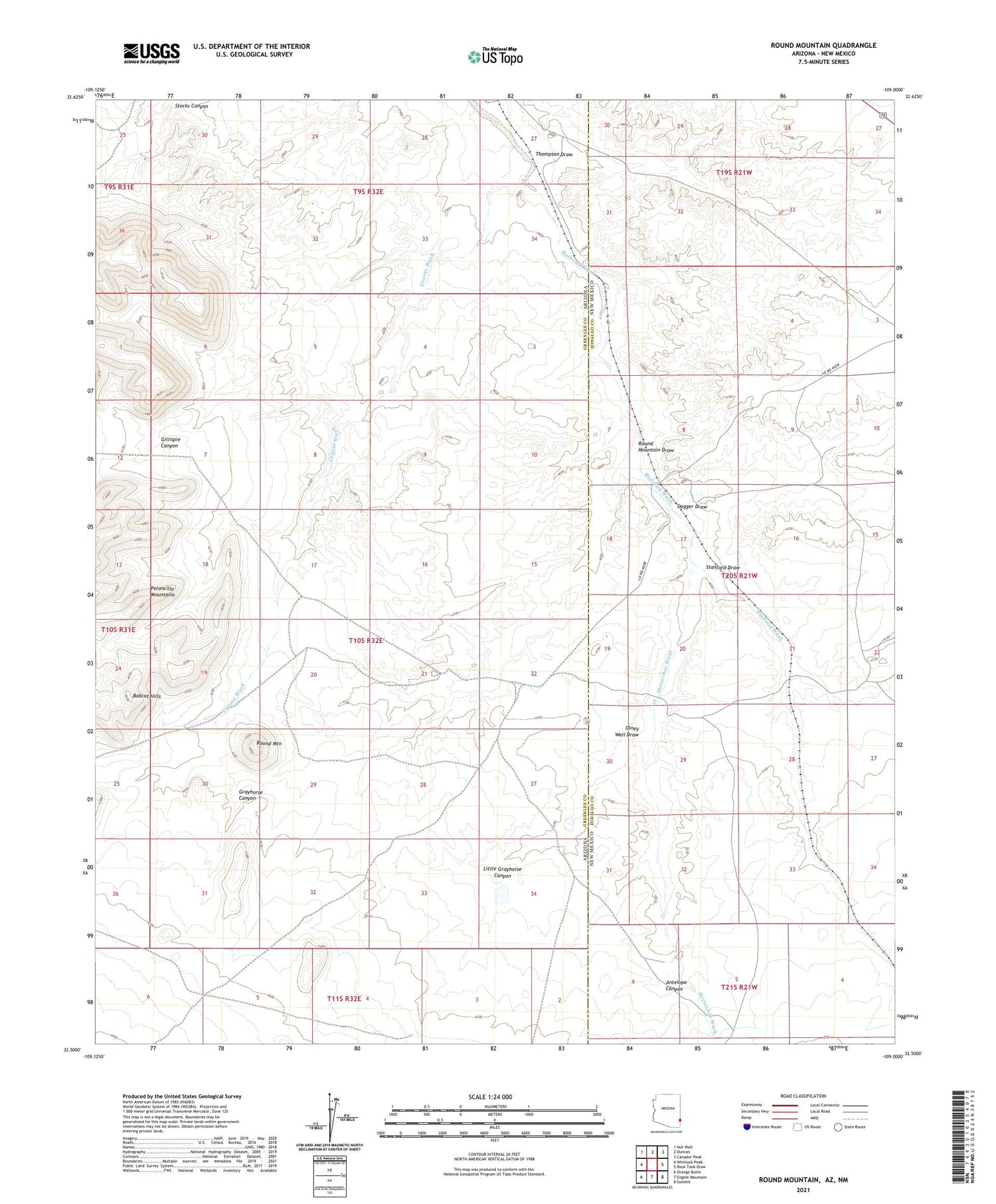
2021 topographic map quadrangle Round Mountain in the states of Arizona, New Mexico. Scale: 1:24000. Based on the newly updated USGS 7.5' US Topo map series, this map is in the following counties: Greenlee, Hidalgo. The map contains contour data, water features, and other items you are used to seeing on USGS maps, but also has updated roads and other features. This is the next generation of topographic maps. Printed on high-quality waterproof paper with UV fade-resistant inks.
Quads adjacent to this one:
West: Whitlock Peak
Northwest: Hot Well
North: Duncan
Northeast: Canador Peak
East: Rock Tank Draw
Southeast: Summit
South: Engine Mountain
Southwest: Orange Butte
Contains the following named places: Antelope Canyon, Antelope Dam, Antelope Draw Dention Dam, Dagger Dam Number 1, Dagger Dam Number 2, Dagger Dam Number 3, Dagger Draw, Day Ranch, Gillispie Canyon, Grayhorse Canyon, Grayhorse Dam, Horseshoe Terrace Dam, Horseshoe Terrace Detention Dam, Horseshoe Wash, Lazy B Ranch Airstrip, Little Grayhorse Canyon, Olney Dam, Olney Well Draw, Railroad Well, Round Mountain, Round Mountain Dam Number 3, Round Mountain Dam Number Two, Round Mountain Draw, Stanford Dam Number 1, Stanford Draw, Starvation Tank, Stateline Dam, Thompson Draw, Twin Dam