MyTopo
Saint David Arizona US Topo Map
Couldn't load pickup availability
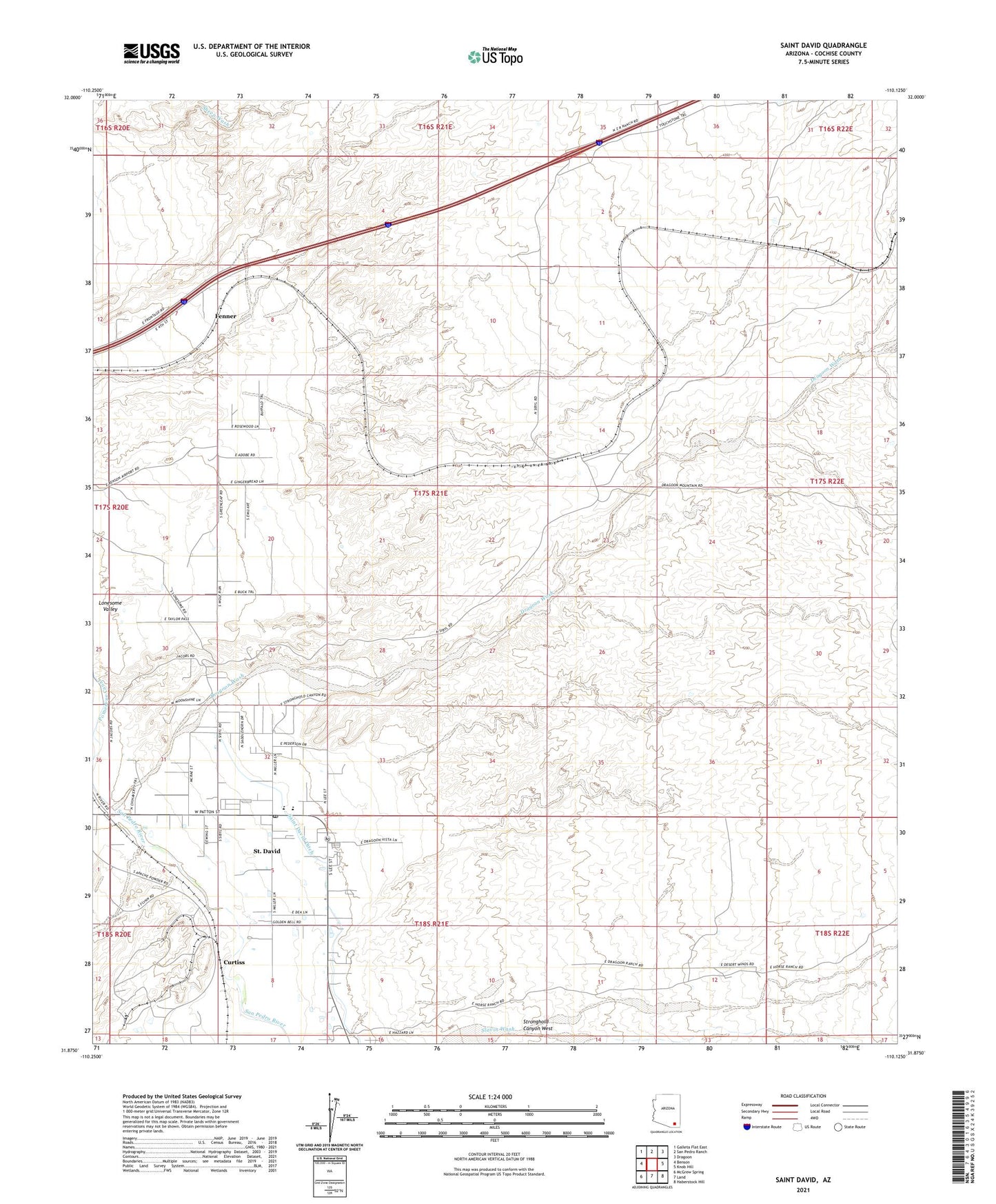
2021 topographic map quadrangle Saint David in the state of Arizona. Scale: 1:24000. Based on the newly updated USGS 7.5' US Topo map series, this map is in the following counties: Cochise. The map contains contour data, water features, and other items you are used to seeing on USGS maps, but also has updated roads and other features. This is the next generation of topographic maps. Printed on high-quality waterproof paper with UV fade-resistant inks.
Quads adjacent to this one:
West: Benson
Northwest: Galleta Flat East
North: San Pedro Ranch
Northeast: Dragoon
East: Knob Hill
Southeast: Haberstock Hill
South: Land
Southwest: McGrew Spring
This map covers the same area as the classic USGS quad with code o31110h2.
Contains the following named places: Apache Mobile Park, CCA Tower, Cochise Stronghold Indian Museum, Curtis Railroad Station, Curtiss, Dragoon Wash, Fenner, Fenner Railroad Station, Lonesome Valley, Saint David, Saint David Census Designated Place, Saint David Elementary School, Saint David High School, Saint David Post Office, Saint David Substation, Sibyl, Sibyl Railroad Station, Stronghold Canyon West, ZIP Code: 85630