MyTopo
San Carlos Arizona US Topo Map
Couldn't load pickup availability
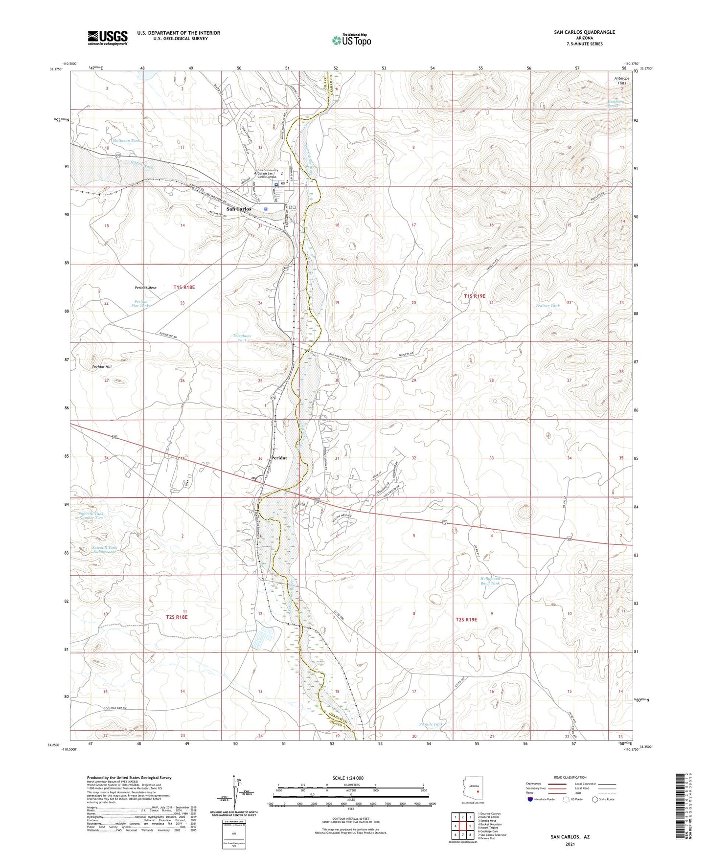
2021 topographic map quadrangle San Carlos in the state of Arizona. Scale: 1:24000. Based on the newly updated USGS 7.5' US Topo map series, this map is in the following counties: Graham, Gila. The map contains contour data, water features, and other items you are used to seeing on USGS maps, but also has updated roads and other features. This is the next generation of topographic maps. Printed on high-quality waterproof paper with UV fade-resistant inks.
Quads adjacent to this one:
West: Bucket Mountain
Northwest: Dourine Canyon
North: Natural Corral
Northeast: Sontag Mesa
East: Mount Triplet
Southeast: Dewey Flat
South: San Carlos Reservoir
Southwest: Coolidge Dam
This map covers the same area as the classic USGS quad with code o33110c4.
Contains the following named places: Gila Community College San Carlos Campus, Gilson Wash, Hackberry Creek, Hackberry Spring, Hollywood Bowl Tank, Hollywood Well, Maltazan Tank, Naltazen Dam, Peridot, Peridot Census Designated Place, Peridot Flat Tanks, Peridot Hill, Peridot Lutheran Elementary School, Peridot Mesa, Peridot Post Office, Peridot Well, Public Health Services Indian Hospital San Carlos Service Unit, Rice Elementary School, Saint Charles Apache Mission School, San Carlos, San Carlos Airport, San Carlos Apache Police Department, San Carlos Census Designated Place, San Carlos Indian Agency, San Carlos Intermediate School, San Carlos Post Office, San Carlos Secondary School, Sawmill Tank Number One, Sawmill Tank Number Two, Sevenmile Wash, Sixmile Tank, Telephone Tank, Trainer Dam, Trainer Tank, Triplet Wash, Tufa Stone Dam