MyTopo
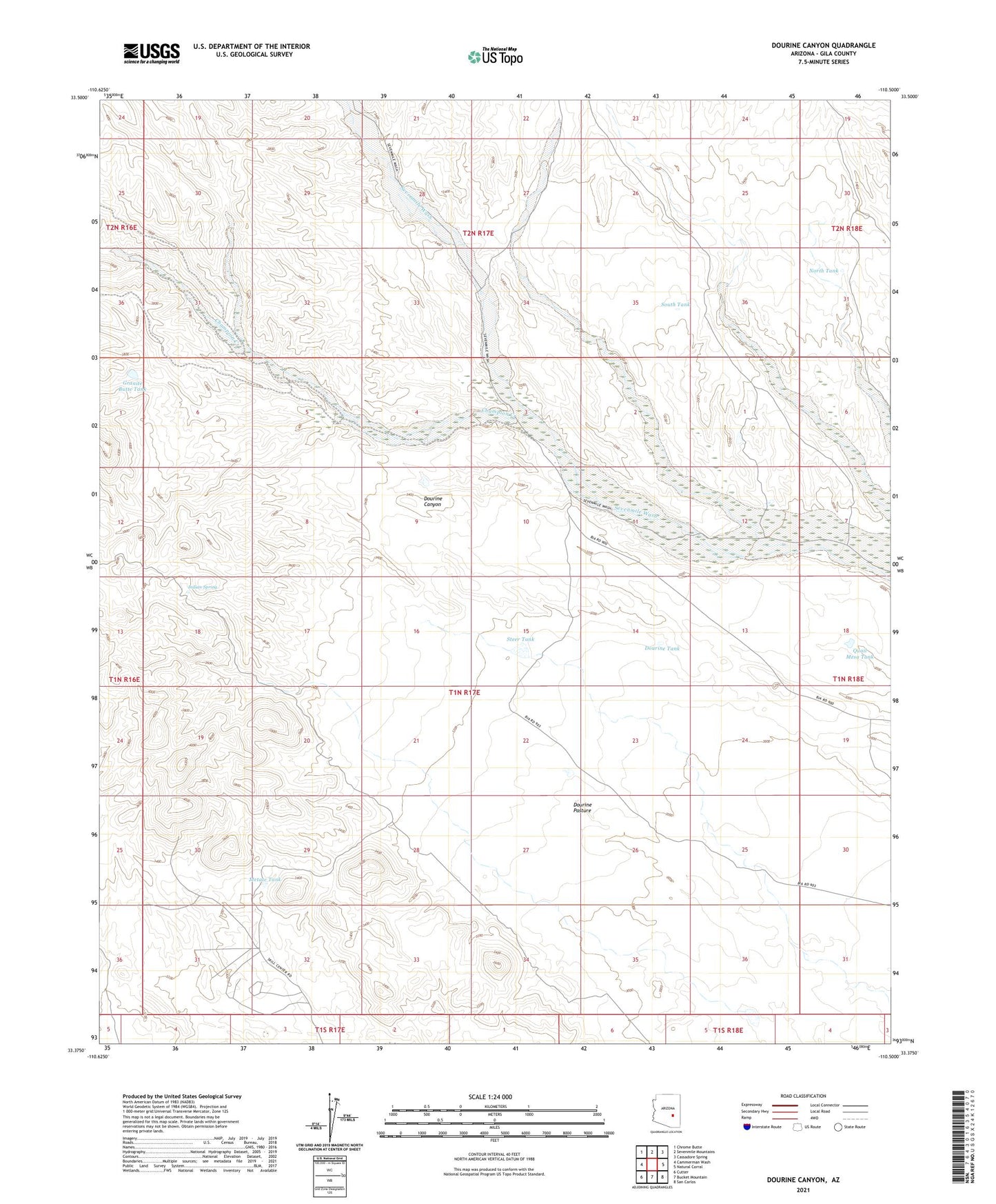
Dourine Canyon Arizona US Topo Map
Couldn't load pickup availability
2021 topographic map quadrangle Dourine Canyon in the state of Arizona. Scale: 1:24000. Based on the newly updated USGS 7.5' US Topo map series, this map is in the following counties: Gila. The map contains contour data, water features, and other items you are used to seeing on USGS maps, but also has updated roads and other features. This is the next generation of topographic maps. Printed on high-quality waterproof paper with UV fade-resistant inks.
Quads adjacent to this one:
West: Cammerman Wash
Northwest: Chrome Butte
North: Sevenmile Mountains
Northeast: Cassadore Spring
East: Natural Corral
Southeast: San Carlos
South: Bucket Mountain
Southwest: Cutter
This map covers the same area as the classic USGS quad with code o33110d5.
Contains the following named places: Champion Creek, Champion Well, Chatlin Well, Circle Seven Ranch, Dourine Detention Dam, Dourine Pasture, Dourine Tank, Granite Butte Dam, Granite Butte Tank, Indian Spring, Metate Dam, Metate Mine, Metate Tank, North Double Dam, North Tank, Polk Well, Quail Mesa Dam, Quail Mesa Tank, South Tank, Steer Dam, Steer Tank