MyTopo
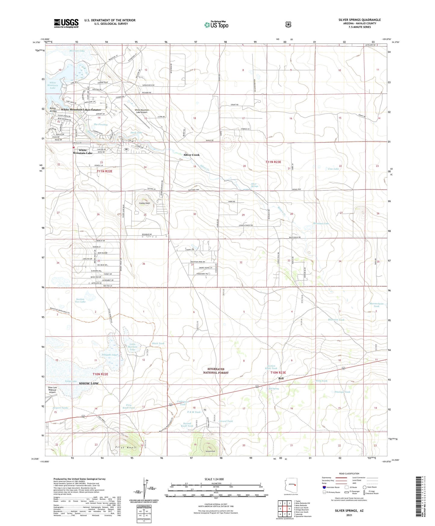
Silver Springs Arizona US Topo Map
Couldn't load pickup availability
Also explore the Silver Springs Forest Service Topo of this same quad for updated USFS data
2021 topographic map quadrangle Silver Springs in the state of Arizona. Scale: 1:24000. Based on the newly updated USGS 7.5' US Topo map series, this map is in the following counties: Navajo. The map contains contour data, water features, and other items you are used to seeing on USGS maps, but also has updated roads and other features. This is the next generation of topographic maps. Printed on high-quality waterproof paper with UV fade-resistant inks.
Quads adjacent to this one:
West: Show Low North
Northwest: Taylor
North: Mesa Redonda NW
Northeast: Mesa Redonda
East: Ortega Mountain
Southeast: Sponseller Mountain
South: Lakeside
Southwest: Show Low South
This map covers the same area as the classic USGS quad with code o34109c8.
Contains the following named places: Accord Tank, Airport Industrial Park, Airport Tanks, Antelope Tank, Bell, Bell Spring, Bluestem Tank, Bourdon Windmill, Brown Creek, Cooley Knoll, Cow Lake, D R M Tank, Daggs Reservoir, Ditch Tank, Duck Lake, First Knoll, First Knoll Tank, Little Mormon Lake, Long Lake, Mannerheim Tank, Martinez Lake, Mexican Lake, Rocky Arroyo, Second Knoll, Second Knoll Tank, Section Eight Tank, Section Five Tank, Section Two Lake, Silver Creek, Silver Creek Golf Club, Silver Creek Post Office, Silver Springs, Sixty Tank, The Forebay, Underpass Tank, Whipple Lake, White Mountain Lake, White Mountain Lake Airport, White Mountain Lake Census Designated Place, White Mountain Lake Community Baptist Church, White Mountain Lake Fire District Station, White Mountain Lake Post Office, White Mountain Lakes Estates