MyTopo
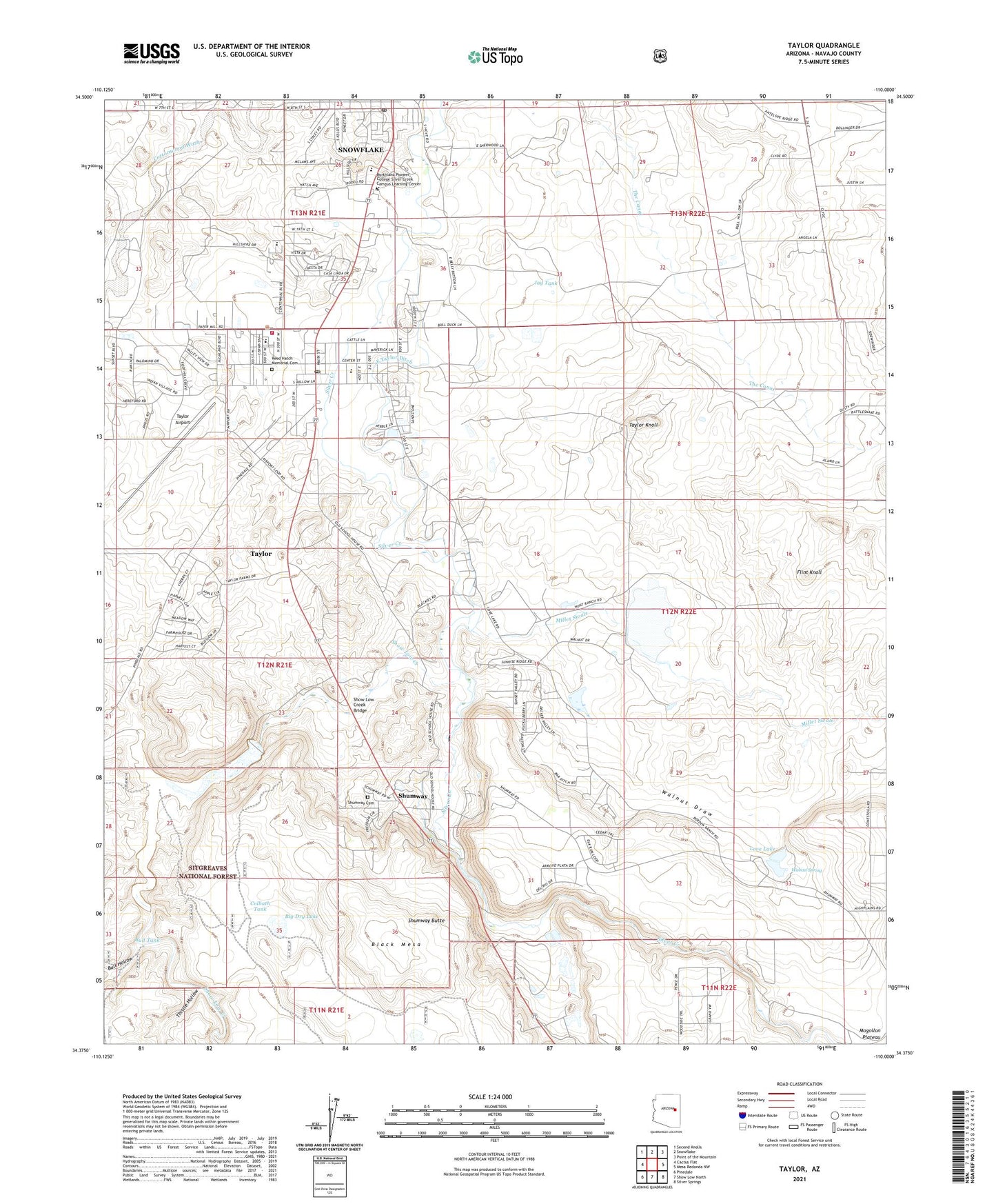
Taylor Arizona US Topo Map
Couldn't load pickup availability
Also explore the Taylor Forest Service Topo of this same quad for updated USFS data
2021 topographic map quadrangle Taylor in the state of Arizona. Scale: 1:24000. Based on the newly updated USGS 7.5' US Topo map series, this map is in the following counties: Navajo. The map contains contour data, water features, and other items you are used to seeing on USGS maps, but also has updated roads and other features. This is the next generation of topographic maps. Printed on high-quality waterproof paper with UV fade-resistant inks.
Quads adjacent to this one:
West: Cactus Flat
Northwest: Second Knolls
North: Snowflake
Northeast: Point of the Mountain
East: Mesa Redonda NW
Southeast: Silver Springs
South: Show Low North
Southwest: Pinedale
This map covers the same area as the classic USGS quad with code o34110d1.
Contains the following named places: Big Dry Lake, Black Mesa, Bull Hollow, Bull Tank, Colbath Tank, Colbath Well, East Taylor Ditch, Flint Knoll, Immanuel Lutheran Church, Jay Tank, Love Lake, Millet Swale, Millet Swale Dam, Millet Swale Reservoir, Northern Arizona Academy, Northland Pioneer College Silver Creek Campus Learning Center, Northland Pioneer College Silver Creek Campus Performing Arts Center, Northland Pioneer College Silver Creek Campus Student Center, Our Lady of the Snow Catholic Church, Park Well, Reed Hatch Memorial Cemetery, Schoens Crossing, Schoens Lake, Show Low Creek, Show Low Creek Bridge, Shumway, Shumway Butte, Shumway Cemetery, Shumway Census Designated Place, Snowflake Junior High School, Snowflake Post Office, Taylor, Taylor - Snowflake Fire and Medical Department, Taylor Airport, Taylor Elementary School, Taylor Fire Department, Taylor Intermediate School, Taylor Knoll, Taylor Post Office, The Church of Jesus Christ of Latter Day Saints, Thistle Hollow, Town of Taylor, Walnut Draw, Walnut Spring, West Shumway Ditch, West Taylor Ditch, ZIP Code: 85939