MyTopo
Sitgreaves Mountain Arizona US Topo Map
Couldn't load pickup availability
Also explore the Sitgreaves Mountain Forest Service Topo of this same quad for updated USFS data
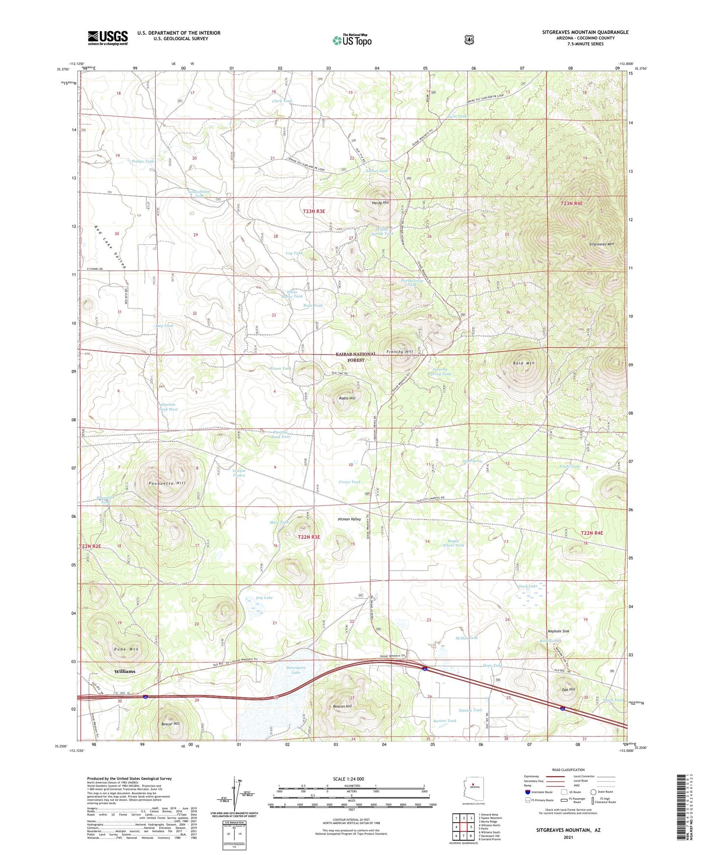
2021 topographic map quadrangle Sitgreaves Mountain in the state of Arizona. Scale: 1:24000. Based on the newly updated USGS 7.5' US Topo map series, this map is in the following counties: Coconino. The map contains contour data, water features, and other items you are used to seeing on USGS maps, but also has updated roads and other features. This is the next generation of topographic maps. Printed on high-quality waterproof paper with UV fade-resistant inks.
Quads adjacent to this one:
West: Williams North
Northwest: Howard Mesa
North: Squaw Mountain
Northeast: Moritz Ridge
East: Parks
Southeast: Garland Prairie
South: Davenport Hill
Southwest: Williams South
This map covers the same area as the classic USGS quad with code o35112c1.
Contains the following named places: Bald Mountain, Beacon Hill, Bird Tank, Boxcar Hill, Buggy Wheel Tank, Burton Tank, Chalender Underpass, Clark Tank, Crowe Tank, Dag Tank, Davenport Lake, Dry Lake, Duck Lake, Dude Mountain, Dude Mountain Tank, Freds Tank, Frenchy Hill, Frenchy Spring Tank, Hardy Hill, Hitson Tank, Hope Tank, Indian Seeps Tank, James Tank, Johns Park, Jonns Park, Keyhole Sink, Locust Tank, Log Tank, McHat Tank, Moss Tank, Oak Hill, Oak Hill Snow Play Area, Pardnership Tank, Pedigo Tank, Perry Tank, Pipeline Tank East, Pipeline Tank West, Pitman Valley Helibase, Pouquette Hill, Pouquette Tank, Radio Hill, Rock Tank, Rock Tank West, Rupe Tank, Schoolhouse Tank, Sitgreaves Mountain, South Tank, Station Tank, T O Tank, Tanque Piedra, Twin Tanks, Wade Spring, White House Tank, Williams - Circle Pines Kampgrounds of America, Willow Spring Tank