MyTopo
Sontag Creek Arizona US Topo Map
Couldn't load pickup availability
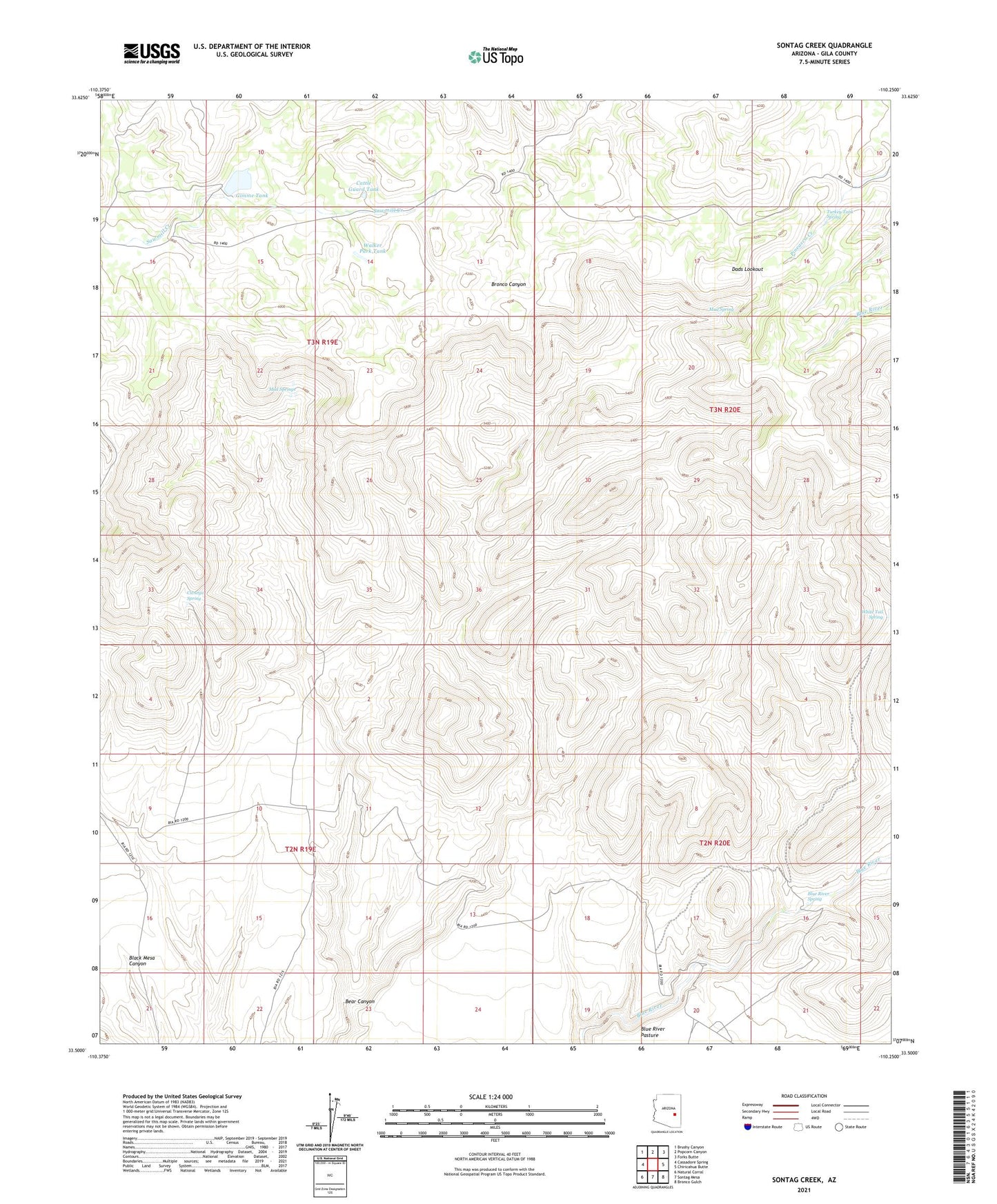
2021 topographic map quadrangle Sontag Creek in the state of Arizona. Scale: 1:24000. Based on the newly updated USGS 7.5' US Topo map series, this map is in the following counties: Gila. The map contains contour data, water features, and other items you are used to seeing on USGS maps, but also has updated roads and other features. This is the next generation of topographic maps. Printed on high-quality waterproof paper with UV fade-resistant inks.
Quads adjacent to this one:
West: Cassadore Spring
Northwest: Brushy Canyon
North: Popcorn Canyon
Northeast: Forks Butte
East: Chiricahua Butte
Southeast: Bronco Gulch
South: Sontag Mesa
Southwest: Natural Corral
This map covers the same area as the classic USGS quad with code o33110e3.
Contains the following named places: Bear Canyon, Bear Canyon Mine, Blue River Spring, Cattle Guard Tank, Cienega Spring, Dads Lookout, Gimme Tank, Mud Spring, Mud Springs, Sontag Creek, Turkey Tank Spring, Walker Park Tank, White Tail Spring