
MyTopo
Forks Butte Arizona US Topo Map
Couldn't load pickup availability
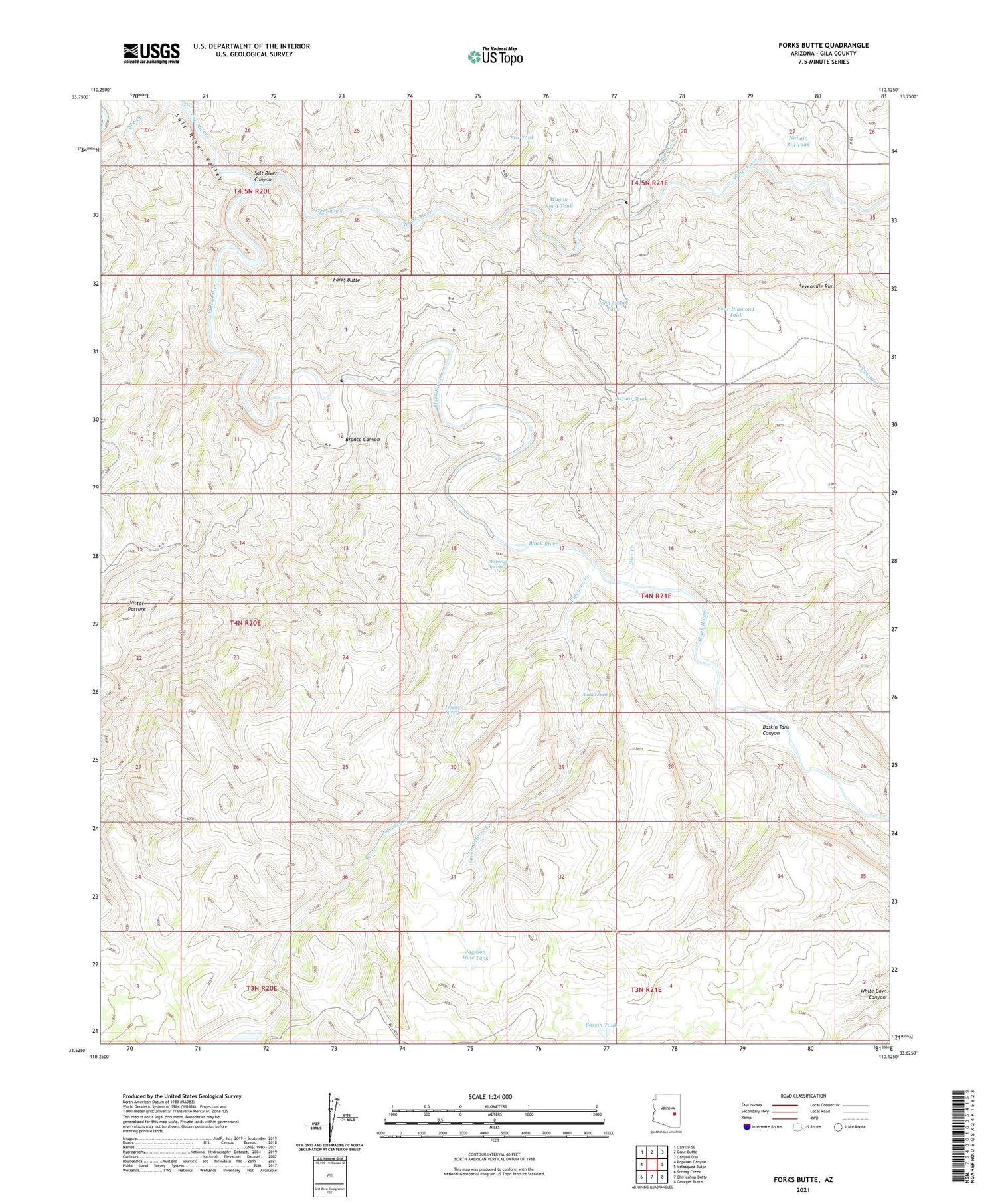
2021 topographic map quadrangle Forks Butte in the state of Arizona. Scale: 1:24000. Based on the newly updated USGS 7.5' US Topo map series, this map is in the following counties: Gila. The map contains contour data, water features, and other items you are used to seeing on USGS maps, but also has updated roads and other features. This is the next generation of topographic maps. Printed on high-quality waterproof paper with UV fade-resistant inks.
Quads adjacent to this one:
West: Popcorn Canyon
Northwest: Carrizo SE
North: Cone Butte
Northeast: Canyon Day
East: Velasquez Butte
Southeast: Georges Butte
South: Chiricahua Butte
Southwest: Sontag Creek
This map covers the same area as the classic USGS quad with code o33110f2.
Contains the following named places: Amos Wash, Baskin Tank, Baskin Tank Canyon, Black River, Black River Crossing, Box Tank, Bread Spring, Bronco Canyon, Calf Creek, Deer Creek, Forks Butte, Four Diamond Tank, Jackson Hole Tank, Jaquar Tank, John Moore Tank, Maverick Spring, Navajo Bill Tank, Packing Horse Creek, Phillips Park Dam, Phillips Park Tank, Pineasco Creek, Pineasco Spring, Wagon Road Tank, Warm Spring, White River


