MyTopo
Popcorn Canyon Arizona US Topo Map
Couldn't load pickup availability
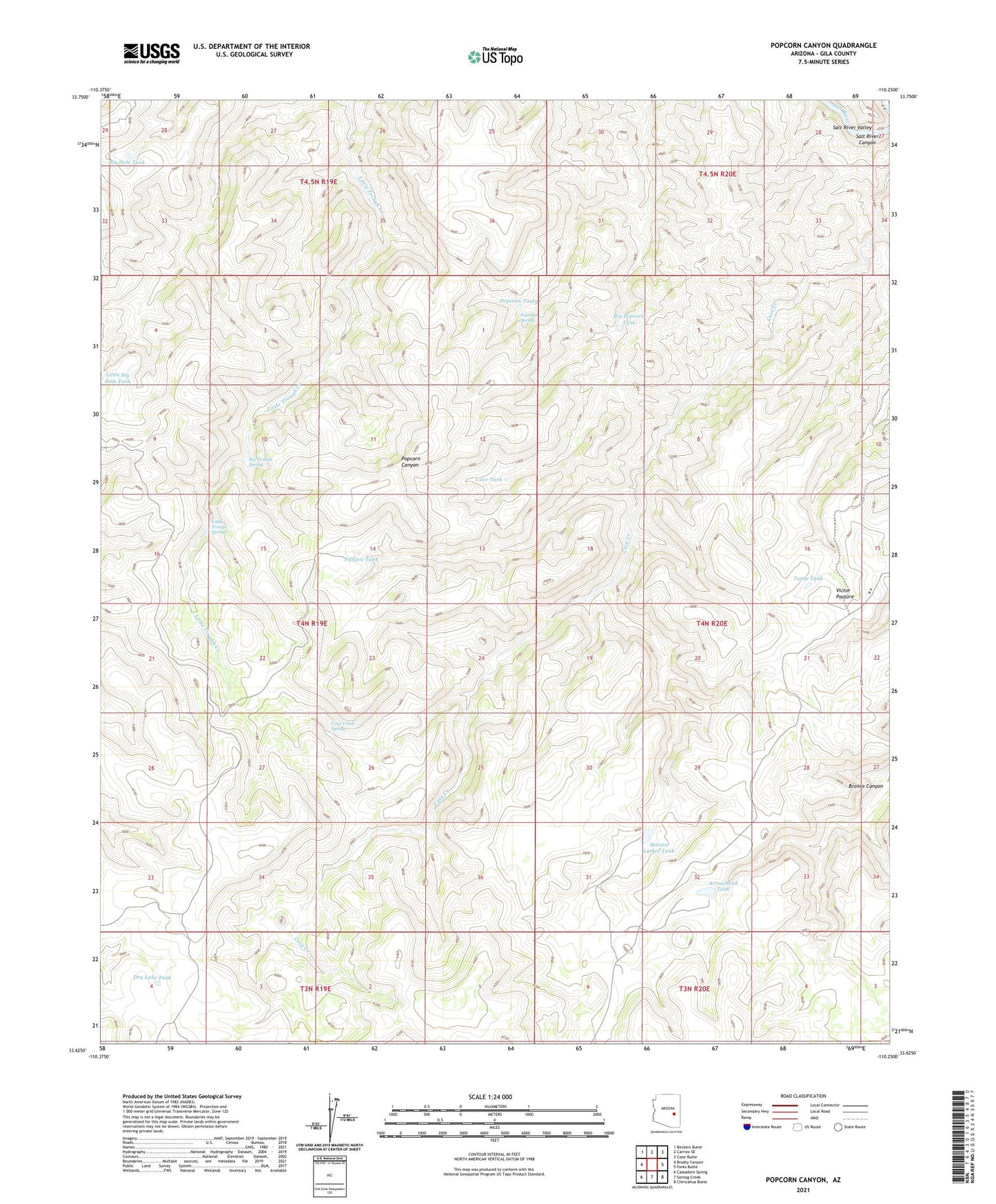
2021 topographic map quadrangle Popcorn Canyon in the state of Arizona. Scale: 1:24000. Based on the newly updated USGS 7.5' US Topo map series, this map is in the following counties: Gila. The map contains contour data, water features, and other items you are used to seeing on USGS maps, but also has updated roads and other features. This is the next generation of topographic maps. Printed on high-quality waterproof paper with UV fade-resistant inks.
Quads adjacent to this one:
West: Brushy Canyon
Northwest: Beckers Butte
North: Carrizo SE
Northeast: Cone Butte
East: Forks Butte
Southeast: Chiricahua Butte
South: Sontag Creek
Southwest: Cassadore Spring
This map covers the same area as the classic USGS quad with code o33110f3.
Contains the following named places: Arrow Head Dam, Arrowhead Tank, Big Hole Tank, Big Popcorn Tank, Big Trough Spring, Cave Creek Spring, Cave Tank, Dry Lake Tank, Fiftysix Tank, Little Big Hole Tank, Little Trough Spring, Martin Luther Dam, Martin Luther Tank, Popcorn Spring, Popcorn Tank, Tank Dam, Tuttle Tank, Victor Pasture