MyTopo
Cassadore Spring Arizona US Topo Map
Couldn't load pickup availability
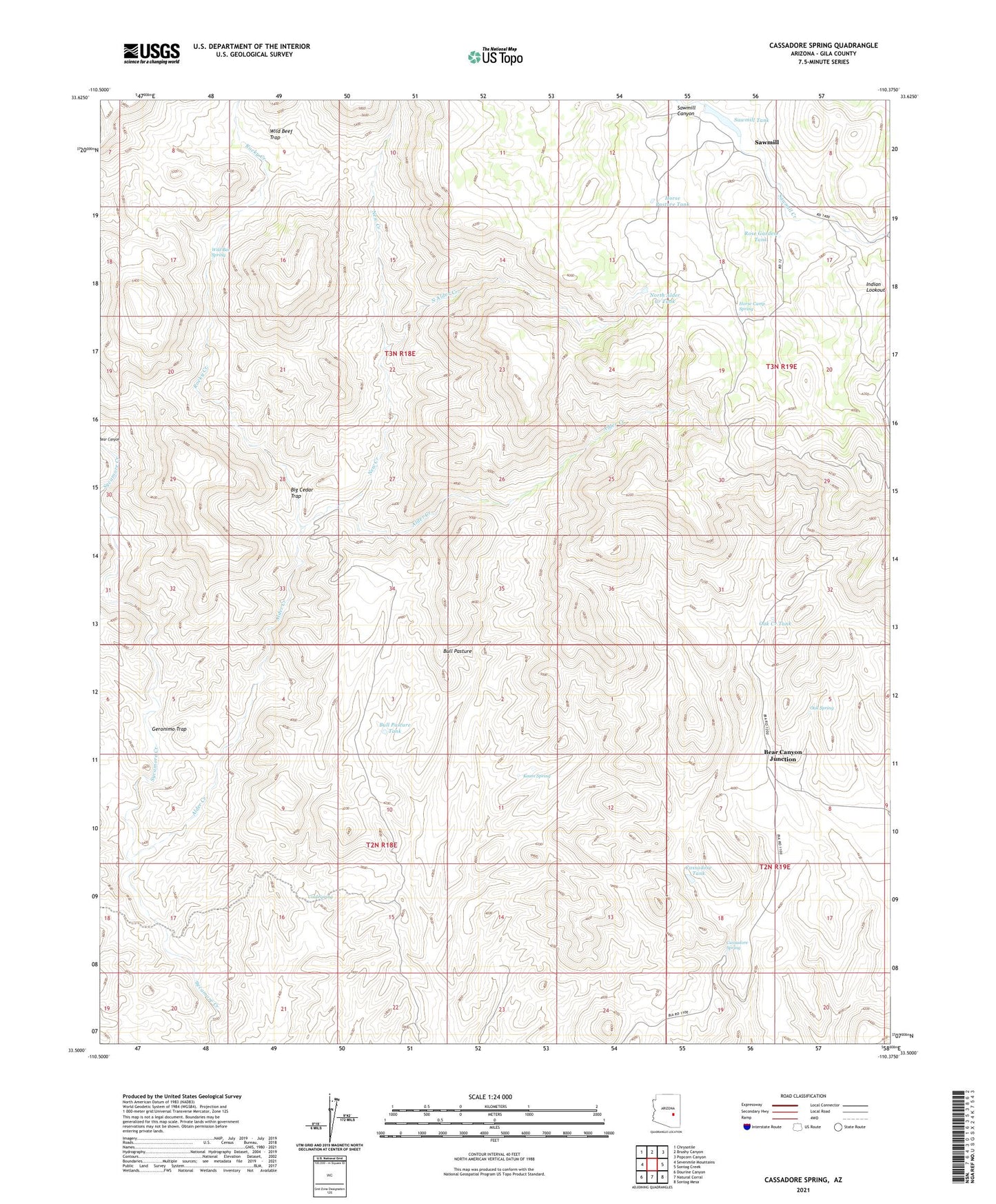
2021 topographic map quadrangle Cassadore Spring in the state of Arizona. Scale: 1:24000. Based on the newly updated USGS 7.5' US Topo map series, this map is in the following counties: Gila. The map contains contour data, water features, and other items you are used to seeing on USGS maps, but also has updated roads and other features. This is the next generation of topographic maps. Printed on high-quality waterproof paper with UV fade-resistant inks.
Quads adjacent to this one:
West: Sevenmile Mountains
Northwest: Chrysotile
North: Brushy Canyon
Northeast: Popcorn Canyon
East: Sontag Creek
Southeast: Sontag Mesa
South: Natural Corral
Southwest: Dourine Canyon
This map covers the same area as the classic USGS quad with code o33110e4.
Contains the following named places: Alder Creek, Bear Canyon Junction, Big Cedar Trap, Bull Pasture, Bull Pasture Tank, Cassadore Spring, Cassadore Tank, Cold Spring, Geronimo Trap, Hilltop Ranch, Horse Camp Spring, Horse Pasture Tank, I K Bar Well, Indian Lookout, Keam Spring, New Creek, North Alder Creek, North Alder Creek Tank, Oak Creek Tank, Oak Spring, Rocky Creek, Rose Garden Tank, Sawmill, Sawmill Dam, Sawmill Tank, Wild Bee Spring, Wild Beef Trap, ZIP Code: 85550