MyTopo
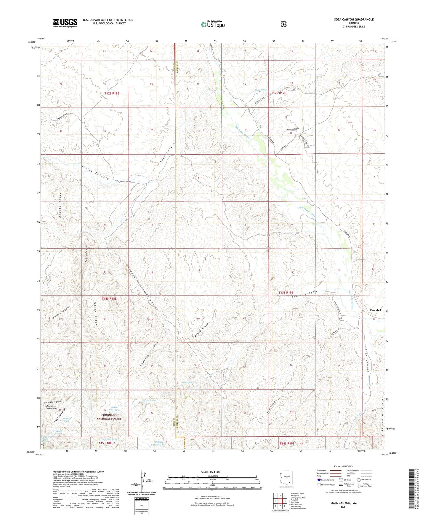
Soza Canyon Arizona US Topo Map
Couldn't load pickup availability
Also explore the Soza Canyon Forest Service Topo of this same quad for updated USFS data
2021 topographic map quadrangle Soza Canyon in the state of Arizona. Scale: 1:24000. Based on the newly updated USGS 7.5' US Topo map series, this map is in the following counties: Cochise, Pima. The map contains contour data, water features, and other items you are used to seeing on USGS maps, but also has updated roads and other features. This is the next generation of topographic maps. Printed on high-quality waterproof paper with UV fade-resistant inks.
Quads adjacent to this one:
West: Piety Hill
Northwest: Buehman Canyon
North: Redington
Northeast: Cherry Spring Peak
East: Soza Mesa
Southeast: Wildhorse Mountain
South: Happy Valley
Southwest: Mica Mountain
This map covers the same area as the classic USGS quad with code o32110c4.
Contains the following named places: Banco Ridge, Bar L Y Ranch, Bolt Canyon, Canada Atravesada Canyon, Cascabel, Cascabel Ranch, Cascabel School, Chimney Canyon, Coffee Pot Tank, Espiritu Canyon, Espiritu Well, Flagtail Spring, Gibson Ranch, Hidden Tank, High Tank, Hot Springs Canyon Creek, Last Chance Trailhead, Middle Canyon Tank, Mineta Ridge, Paige Canyon, Paige Creek, Pelon Spring, Roble Canyon, Roble Spring, Saucito Canyon, Soza Canyon, Soza Ranch, Soza Wash, Spear Ranch, Tres Pipas Canyon, West Fork Aliso Spring, White Ridge, Willow Spring, Youtcy Canyon