MyTopo
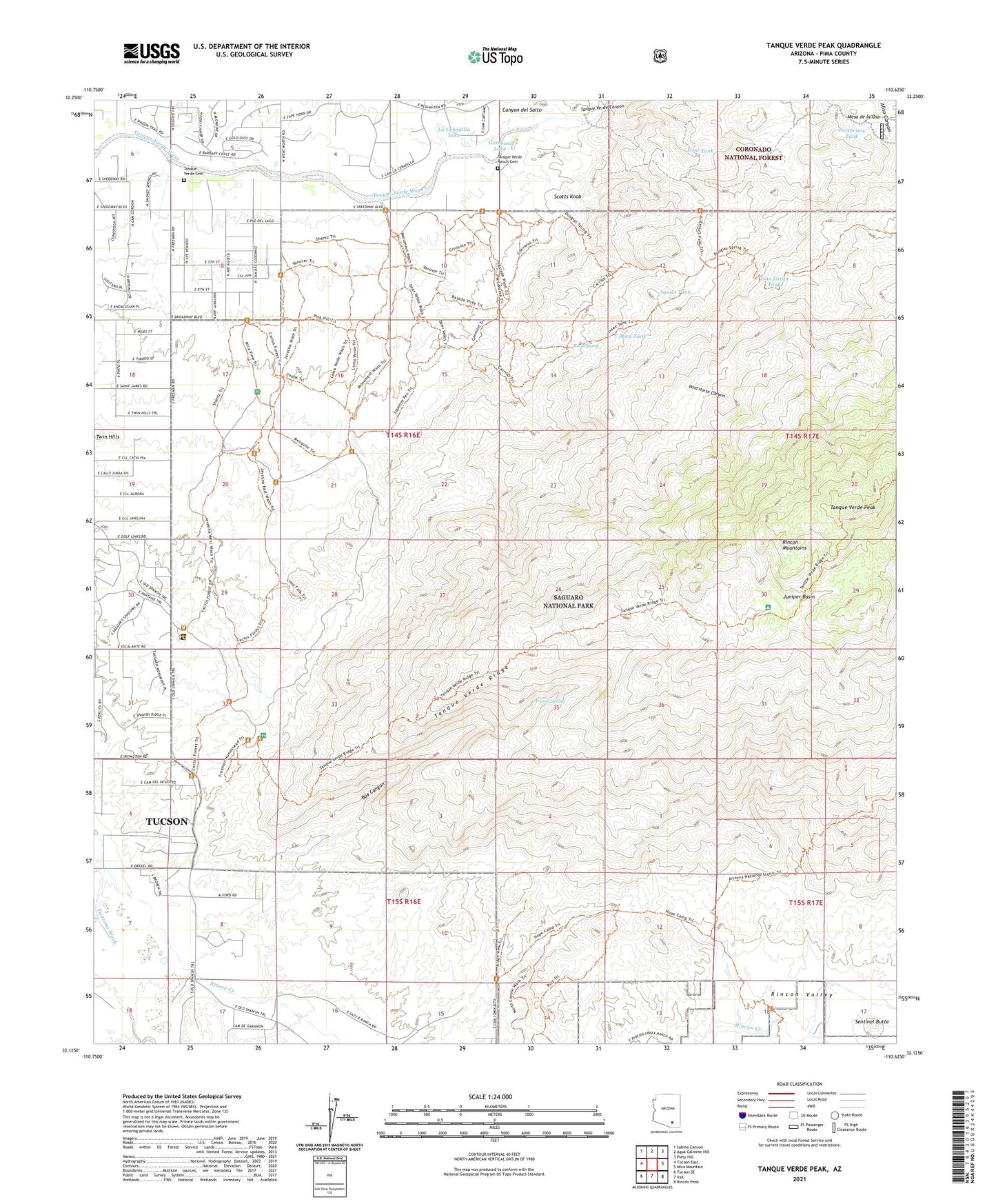
Tanque Verde Peak Arizona US Topo Map
Couldn't load pickup availability
Also explore the Tanque Verde Peak Forest Service Topo of this same quad for updated USFS data
2021 topographic map quadrangle Tanque Verde Peak in the state of Arizona. Scale: 1:24000. Based on the newly updated USGS 7.5' US Topo map series, this map is in the following counties: Pima. The map contains contour data, water features, and other items you are used to seeing on USGS maps, but also has updated roads and other features. This is the next generation of topographic maps. Printed on high-quality waterproof paper with UV fade-resistant inks.
Quads adjacent to this one:
West: Tucson East
Northwest: Sabino Canyon
North: Agua Caliente Hill
Northeast: Piety Hill
East: Mica Mountain
Southeast: Rincon Peak
South: Vail
Southwest: Tucson SE
This map covers the same area as the classic USGS quad with code o32110b6.
Contains the following named places: Aguila Corral, Aguila Tank, Box Canyon, Canyon del Salto, Cement Cabin, Deer Camp, First Tank, Forty Niner Golf and Country Club, Forty-Nine Country Club, Fresno Spring, Gambusi Lake, Hope Camp, Juniper Basin, KRKR-AM (Tucson Estates), La Cebadilla Lake, La Mesa del Oso Tank, Mesa de la Osa, Mica Tank, Old Spanish Trail Church, Portoritas Tank, Rincon Creek, Rincon Valley, Rock Spring, Saguaro Buttes Community Church, Saguaro Wilderness, Scotts Knob, Sentinel Butte, Steel Tank, Tanque Verde Canyon, Tanque Verde Cemetery, Tanque Verde Peak, Tanque Verde Ranch, Tanque Verde Ranch Cemetery, Tanque Verde Ridge, Tanque Verde Ridge Trail, Thunderbird Ranch, Thunderhead Airport, Tina Larga Tank, Twin Hills, Wild Horse Canyon, Wild Horse Corral, ZIP Code: 85730