MyTopo
Upper Wheatfields Arizona US Topo Map
Couldn't load pickup availability
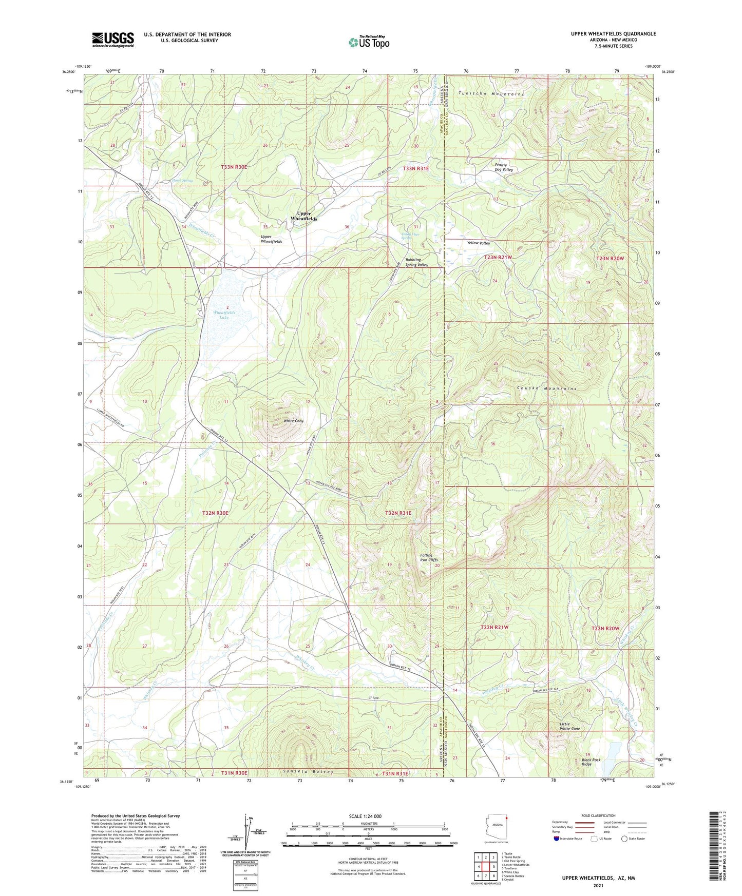
2021 topographic map quadrangle Upper Wheatfields in the states of Arizona, New Mexico. Scale: 1:24000. Based on the newly updated USGS 7.5' US Topo map series, this map is in the following counties: Apache, San Juan. The map contains contour data, water features, and other items you are used to seeing on USGS maps, but also has updated roads and other features. This is the next generation of topographic maps. Printed on high-quality waterproof paper with UV fade-resistant inks.
Quads adjacent to this one:
West: Lower Wheatfields
Northwest: Tsaile
North: Tsaile Butte
Northeast: Old Pine Spring
East: Toadlena
Southeast: Crystal
South: Sonsela Buttes
Southwest: White Clay
Contains the following named places: Black Wood Dam, Bubbling Spring Valley, Falling Iron Cliffs, Horse Spring, Little Whiskey Creek, Little White Cone, Little White Cone Lake, Little Whitecone Lake Dam, Prairie Dog Valley, Teddy Chee Spring, Upper Wheatfields, Wheatfield Dam, Wheatfields Lake, White Cone, Yellow Valley