MyTopo
Cotton City New Mexico US Topo Map
Couldn't load pickup availability
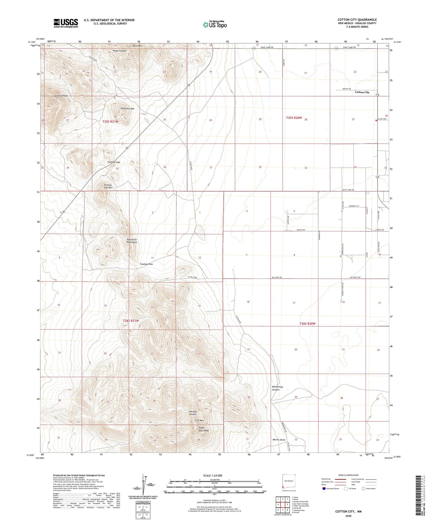
2023 topographic map quadrangle Cotton City in the state of New Mexico. Scale: 1:24000. Based on the newly updated USGS 7.5' US Topo map series, this map is in the following counties: Hidalgo. The map contains contour data, water features, and other items you are used to seeing on USGS maps, but also has updated roads and other features. This is the next generation of topographic maps. Printed on high-quality waterproof paper with UV fade-resistant inks.
Quads adjacent to this one:
West: San Simon Cienega
Northwest: Vanar
North: Steins
Northeast: Swallow Fork Peak
East: Table Top Mountain
Southeast: Animas
South: Antelope Pass
Southwest: Portal NE
This map covers the same area as the classic USGS quad with code o32108a8.
Contains the following named places: 10082 Water Well, 10096 Water Well, 10403 Water Well, 1117 Mountain, Alf Windmill, Bert Windmill, Blue Hill Mine, Blue Mountain, Cotton City, Cotton City Census Designated Place, Cotton City Volunteer Fire Department, Cowboy Pass, Crystal Mine, Eagle Nest Peak, Granddad Windmill, Granite Gap, Granite Gap Mines, Granite Gap Mountain, Granite Peak, Martin Draw, Martin Windmill, McCarty Ranch, Montgomery Mine, Preacher Mountain, Richardson Windmill, Scheelite Group, Valley View Community Church, Vesley Mine, Ward Mine, Washburn Ranch, Weatherby Canyon, Weatherby Ranch