MyTopo
San Simon Cienega New Mexico US Topo Map
Couldn't load pickup availability
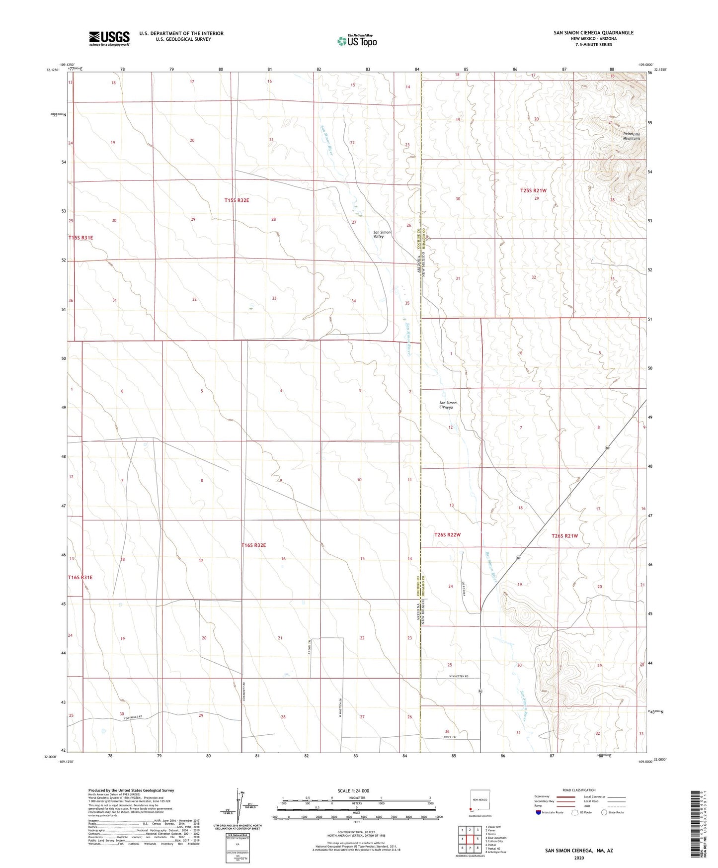
2023 topographic map quadrangle San Simon Cienega in the states of Arizona, New Mexico. Scale: 1:24000. Based on the newly updated USGS 7.5' US Topo map series, this map is in the following counties: Hidalgo, Cochise. The map contains contour data, water features, and other items you are used to seeing on USGS maps, but also has updated roads and other features. This is the next generation of topographic maps. Printed on high-quality waterproof paper with UV fade-resistant inks.
Quads adjacent to this one:
West: Blue Mountain
Northwest: Vanar NW
North: Vanar
Northeast: Steins
East: Cotton City
Southeast: Antelope Pass
South: Portal NE
Southwest: Portal
This map covers the same area as the classic USGS quad with code o32109a1.
Contains the following named places: 0900 Water Well, Cienega Ranch, East Turkey Creek, Flourite Pits, San Simon Cienega