MyTopo
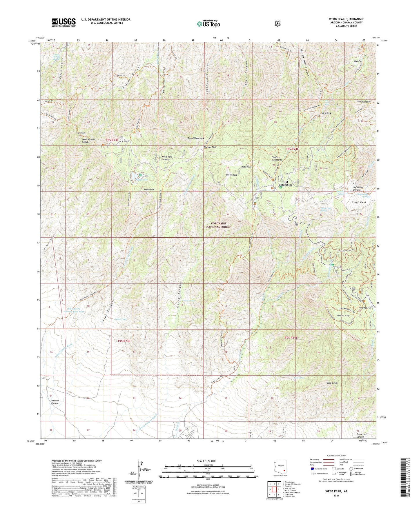
Webb Peak Arizona US Topo Map
Couldn't load pickup availability
Also explore the Webb Peak Forest Service Topo of this same quad for updated USFS data
2021 topographic map quadrangle Webb Peak in the state of Arizona. Scale: 1:24000. Based on the newly updated USGS 7.5' US Topo map series, this map is in the following counties: Graham. The map contains contour data, water features, and other items you are used to seeing on USGS maps, but also has updated roads and other features. This is the next generation of topographic maps. Printed on high-quality waterproof paper with UV fade-resistant inks.
Quads adjacent to this one:
West: Blue Jay Peak
Northwest: Tripp Canyon
North: Shingle Mill Mountain
Northeast: Thatcher
East: Mount Graham
Southeast: Stockton Pass
South: Fort Grant
Southwest: Sierra Bonita Ranch
This map covers the same area as the classic USGS quad with code o32109f8.
Contains the following named places: Arizona Bible School, Ash Creek Falls, Babcock Canyon, Bear Spring, Bearwallow Spring, C P Flat, Carter Sawmill Spring, Chesley Flat, Clark Park Trail Three hundred one, Clark Peak, Clark Peak Ranger Station, Columbine Ranger Station, Cunningham Creek, Cunningham Family Campground, Deadman Tank, Emerald Spring, Fort Grant Vista Point, Goudy Canyon, Goudy Spring, Grand View Peak, Grant Creek Three hundred five Trail, Grant Hill, Hawk Peak, Hawk Peak Spring, Highwater Cienega, Horse Camp, Hospital Flat, Hospital Flat Recreation Area, Jesus Canyon, Jesus Goudy Ridge Trail Two hundred ninety eight, Jesus Tank, Los Girls Camp, Merrill Peak, Moonshine Creek, Mount Graham International Observatory, Mount Graham Mill Site, Mount Graham Sawmill, Oak Flat, Old Columbine, Peters Flat, Post Creek, Riggs Flat Campground, Riggs Flat Dam, Riggs Flat Recreation Area, Riggs Lake, Slick Rock, Soldier Creek, Soldier Creek Campground, Soldier Creek Recreation Area, Stanberry Ranch, Stansberry Number Four Tank, The Pinnacles, Webb Peak