MyTopo
Shingle Mill Mountain Arizona US Topo Map
Couldn't load pickup availability
Also explore the Shingle Mill Mountain Forest Service Topo of this same quad for updated USFS data
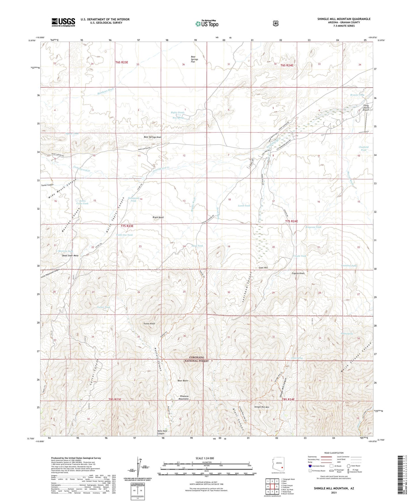
2023 topographic map quadrangle Shingle Mill Mountain in the state of Arizona. Scale: 1:24000. Based on the newly updated USGS 7.5' US Topo map series, this map is in the following counties: Graham. The map contains contour data, water features, and other items you are used to seeing on USGS maps, but also has updated roads and other features. This is the next generation of topographic maps. Printed on high-quality waterproof paper with UV fade-resistant inks.
Quads adjacent to this one:
West: Tripp Canyon
Northwest: Telegraph Wash
North: Eden
Northeast: Pima
East: Thatcher
Southeast: Mount Graham
South: Webb Peak
Southwest: Blue Jay Peak
This map covers the same area as the classic USGS quad with code o32109g8.
Contains the following named places: Bear Basin, Bear Springs, Bear Springs Knoll, Bear Springs Wash, Bigler Ponds, Blair Canyon, Browns Tank, Bryce Knoll, Carter Canyon, Carter Canyon Number Thirty four Trail, Carter Tank, Chatfield Pond, Cottonwood Creek, Coyote Knoll, Coyote Tank, Dead Steer Mesa, Dickey Spring, Flying J Ranch Airport, Goat Hill, Green Spring, Hells Hole Canyon, Hells Hole Creek, Hulda Gap Corral, Lamb Hotel, Lamb Tank, Lefthand Canyon, Little Righthand Canyon, Merrill Wash, Mexican Canyon, Mexican Tank, Middle Wash, North Taylor Canyon, Nuttall Canyon, Pima Well, Ringcone Tank, Sand Tank, Sand Wash, Seven Cross Tank, Shingle Mill Canyon, Shingle Mill Mesa Thirty Five Trail, Shingle Mill Mountain, Squaw Tank, Stockpond Tank, Stowe Knoll, Tramline Tank, Tunnel Canyon, Webb One Tank, Wide Mouth Canyon