MyTopo
Wolf Hole Mountain West Arizona US Topo Map
Couldn't load pickup availability
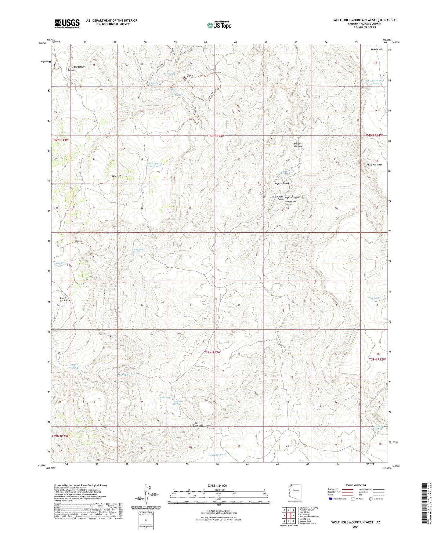
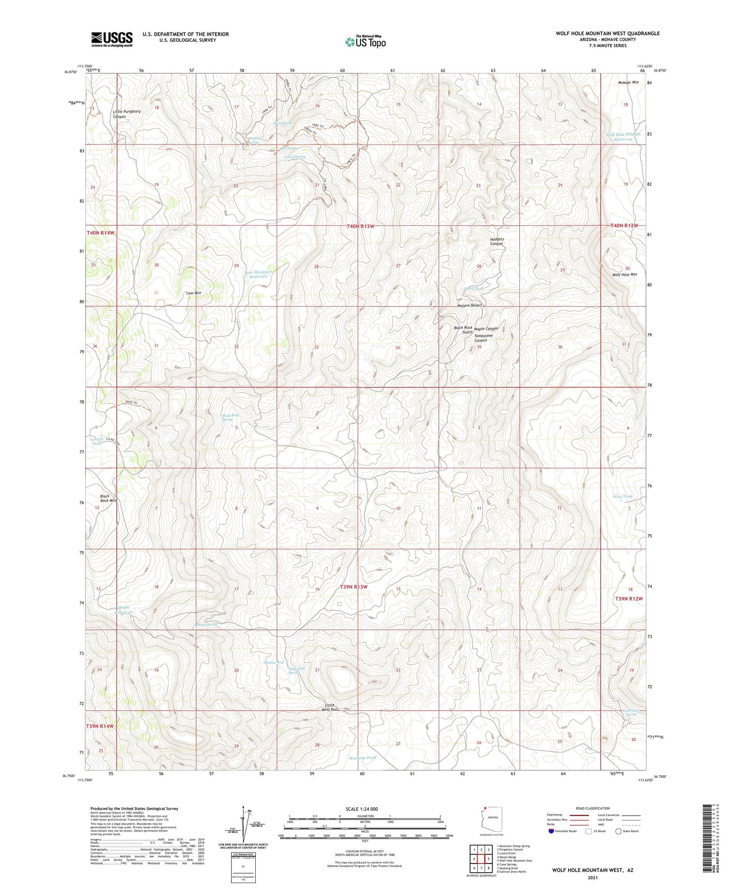
2021 topographic map quadrangle Wolf Hole Mountain West in the state of Arizona. Scale: 1:24000. Based on the newly updated USGS 7.5' US Topo map series, this map is in the following counties: Mohave. The map contains contour data, water features, and other items you are used to seeing on USGS maps, but also has updated roads and other features. This is the next generation of topographic maps. Printed on high-quality waterproof paper with UV fade-resistant inks.
Quads adjacent to this one:
West: Mount Bangs
Northwest: Mountain Sheep Spring
North: Purgatory Canyon
Northeast: Lizard Point
East: Wolf Hole Mountain East
Southeast: Sullivan Draw North
South: Mustang Knoll
Southwest: Cane Springs
This map covers the same area as the classic USGS quad with code o36113g6.
Contains the following named places: Alkaline Seep, Atkin Spring, Black Rock Spring, Hodgets Canyon, Larson Tank, Little Wolf Pass, Little Wolf Spring, Locust Spring, Low Mountain, Low Mountain Reservoir, Maple Canyon, Maple Reservoir, Maple Spring, Mustang Pond, Mustang Spring, Oak Spring, Pond Tank, Tombstone Canyon, Tombstone Spring, West Tank, Wolf Hole Wildlife Reservoir