
MyTopo
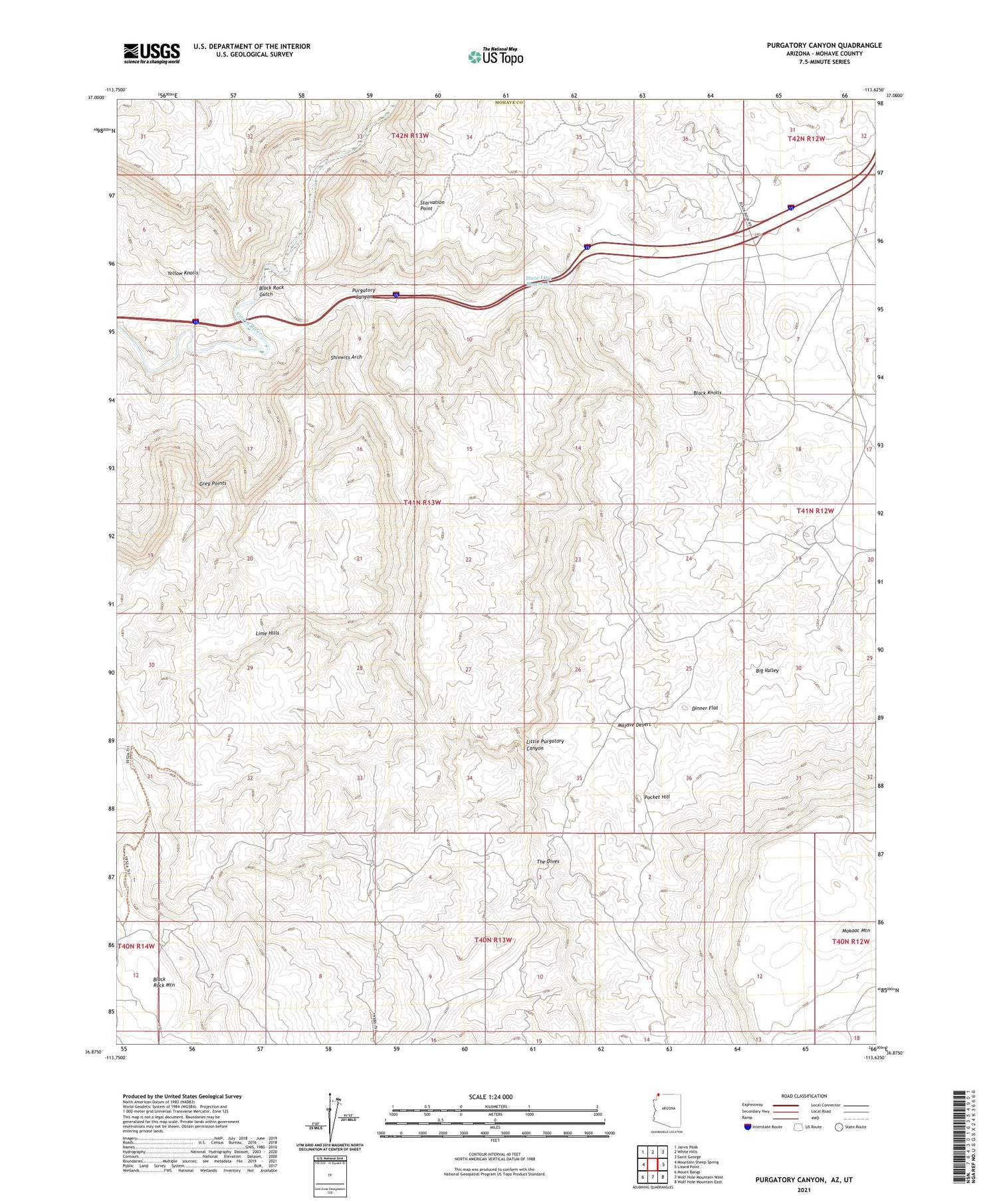
Purgatory Canyon Arizona US Topo Map
Couldn't load pickup availability
2021 topographic map quadrangle Purgatory Canyon in the state of Arizona. Scale: 1:24000. Based on the newly updated USGS 7.5' US Topo map series, this map is in the following counties: Mohave, Washington. The map contains contour data, water features, and other items you are used to seeing on USGS maps, but also has updated roads and other features. This is the next generation of topographic maps. Printed on high-quality waterproof paper with UV fade-resistant inks.
Quads adjacent to this one:
West: Mountain Sheep Spring
Northwest: Jarvis Peak
North: White Hills
Northeast: Saint George
East: Lizard Point
Southeast: Wolf Hole Mountain East
South: Wolf Hole Mountain West
Southwest: Mount Bangs
Contains the following named places: Black Knolls, Black Rock Gulch, Blakes Lambing Grounds, Dinner Flat, Grey Points, Lime Hills, Little Purgatory Canyon, Mokaac Mountain, Pocket Hill, Purgatory Canyon, Shivwits Arch, Starvation Point, State Line Reservoir, The Dives, Yellow Knolls


