MyTopo
Mountain Sheep Spring Arizona US Topo Map
Couldn't load pickup availability
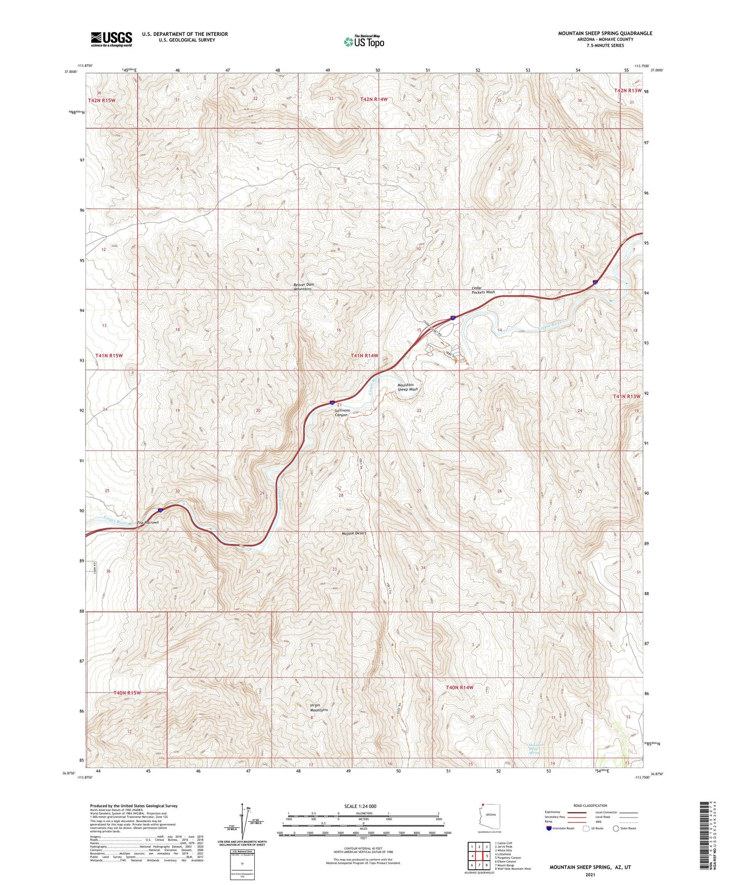
2021 topographic map quadrangle Mountain Sheep Spring in the state of Arizona. Scale: 1:24000. Based on the newly updated USGS 7.5' US Topo map series, this map is in the following counties: Mohave, Washington. The map contains contour data, water features, and other items you are used to seeing on USGS maps, but also has updated roads and other features. This is the next generation of topographic maps. Printed on high-quality waterproof paper with UV fade-resistant inks.
Quads adjacent to this one:
West: Littlefield
Northwest: Castle Cliff
North: Jarvis Peak
Northeast: White Hills
East: Purgatory Canyon
Southeast: Wolf Hole Mountain West
South: Mount Bangs
Southwest: Elbow Canyon
Contains the following named places: Beaver Dam Mountains Wilderness, Cedar Pockets Wash, Figure Four Canyon, Mountain Sheep Spring, Mountain Sheep Wash, Sullivans Canyon, The Narrows