MyTopo
Amity Arkansas US Topo Map
Couldn't load pickup availability
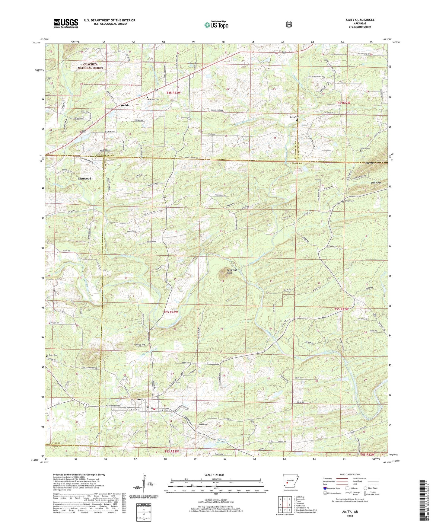
2024 topographic map quadrangle Amity in the state of Arkansas. Scale: 1:24000. Based on the newly updated USGS 7.5' US Topo map series, this map is in the following counties: Clark, Montgomery, Pike, Hot Spring. The map contains contour data, water features, and other items you are used to seeing on USGS maps, but also has updated roads and other features. This is the next generation of topographic maps. Printed on high-quality waterproof paper with UV fade-resistant inks.
Quads adjacent to this one:
West: Glenwood
Northwest: Caddo Gap
North: Bonnerdale
Northeast: Pearcy
East: Point Cedar
Southeast: Chalybeate Mountain East
South: Chalybeate Mountain West
Southwest: Murfreesboro NE
This map covers the same area as the classic USGS quad with code o34093c4.
Contains the following named places: Amity, Amity Elementary School, Amity High School, Amity Police Department, Amity Post Office, Amity Volunteer Fire Department, Bonner School, Bonnerdale Church, Caney Creek, City of Amity, Coker Cemetery, Dillard Cemetery, Elm, Ewing Cemetery, First Church of the Nazarene, Grandview School, Jones Cemetery, Kirksey Reservoir, Kirksey Reservoir Dam, Little Mountain, Little Sugarloaf Creek, Midway Church, Mount Pisgah Missionary Baptist Church, Mount Tabor Church, Newcomb Cemetery, Old Mount Tabor Church, Pisgah School, Prayer House Tabernacle Church, Salem Church, Shiloh Cemetery, Shiloh Church, Sugarloaf Creek, Sugarloaf Knob, Sweet Home Church, Thompson Chapel, Township of Caney, Welch School, Welsh