MyTopo
Arkadelphia Arkansas US Topo Map
Couldn't load pickup availability
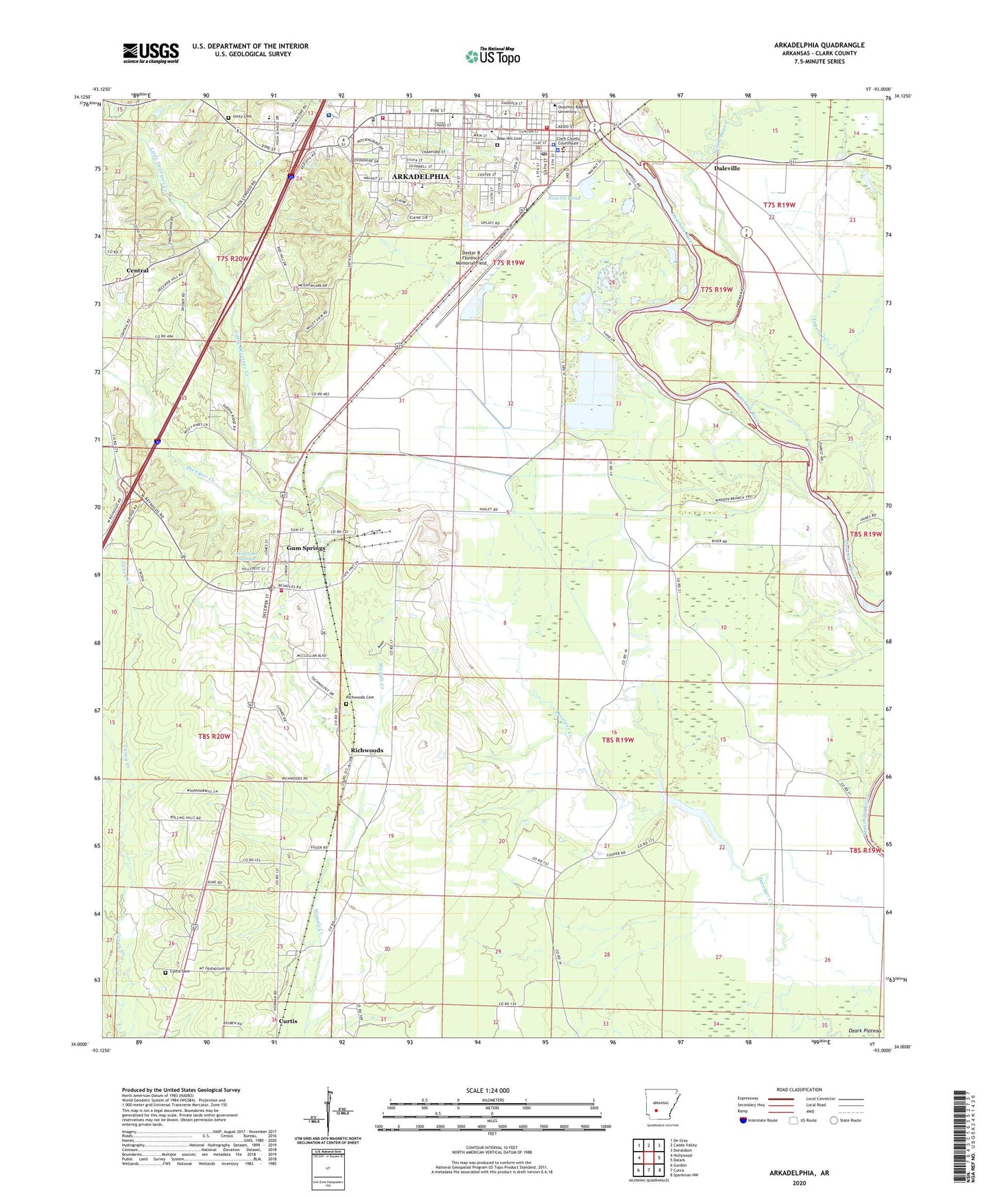
2024 topographic map quadrangle Arkadelphia in the state of Arkansas. Scale: 1:24000. Based on the newly updated USGS 7.5' US Topo map series, this map is in the following counties: Clark. The map contains contour data, water features, and other items you are used to seeing on USGS maps, but also has updated roads and other features. This is the next generation of topographic maps. Printed on high-quality waterproof paper with UV fade-resistant inks.
Quads adjacent to this one:
West: Hollywood
Northwest: De Gray
North: Caddo Valley
Northeast: Donaldson
East: Dalark
Southeast: Sparkman NW
South: Curtis
Southwest: Gurdon
This map covers the same area as the classic USGS quad with code o34093a1.
Contains the following named places: Arkadelphia, Arkadelphia City Hall, Arkadelphia Fire Department Station 1, Arkadelphia Fire Station 2, Arkadelphia High School, Arkadelphia Police Department, Arkadelphia Post Office, Arkadelphia Wastewater Treatment Plant, Baptist Health Arkadelphia Hospital, Baptist Health Medical Center - Arkadelphia, Baring Cross Missionary Baptist Church, Berry Chapel, Central, Central Primary School, Central School, Church of Christ, Church of Christ Holiness, Church of the Nazarene, Clark County Courthouse, Clark County Fairgrounds, Clark County Health Center, Clark County Jail, Clark County Library, Clark County Memorial Hospital, Clark County Sheriff's Office, Concer Hall, Curtis Cemetery, Daleville, David Temple Church of God in Christ, Deceiper Lake, Dexter B Florence Memorial Field, Ebenezer Church of God in Christ, Faith Missionary Baptist Church, First Assembly of God Church, First Baptist Church, First Christian Church, First Presbyterian Church, First United Methodist Church, First United Pentecostal Church, Flennicken Memorial Students Center, Gennesaret Missionary Baptist Church, Goz Junior High School, Goza Middle School, Gum Springs, Gum Springs Baptist Church, Gum Springs Volunteer Fire Department, Interchange 73, J R Grant Memorial Administration Building, KDEL-FM (Arkadelphia), KVRC-AM (Arkadelphia), Lakeview Baptist Church, Little Deceiper Creek, Louisa E Perritt Primary School, Midway, Mitchell Hall, Mount Zion Baptist Church, New Life Church, Nowlin Pond, Oak Grove Church, Ozark Plateau, Park Hill Baptist Church, Peake Elementary School, Peake High School, Perritt Elementary School, Pine Plaza Shopping Center, Richwoods, Richwoods Baptist Church, Richwoods Cemetery, Rose Hill Cemetery, Saint Andrew United Methodist Church, Saint Marys Catholic Church, Saint Michaels Episcopal Church, Saint Paul African Methodist Episcopal Church, Saline Bayou, Second Baptist Church, Sturgis Field, Third Street Baptist Church, Town of Gum Springs, Tupelo Creek, Unity Cemetery, Walnut Street Missionary Baptist Church, West Gum Springs, ZIP Code: 71923