MyTopo
Gurdon Arkansas US Topo Map
Couldn't load pickup availability
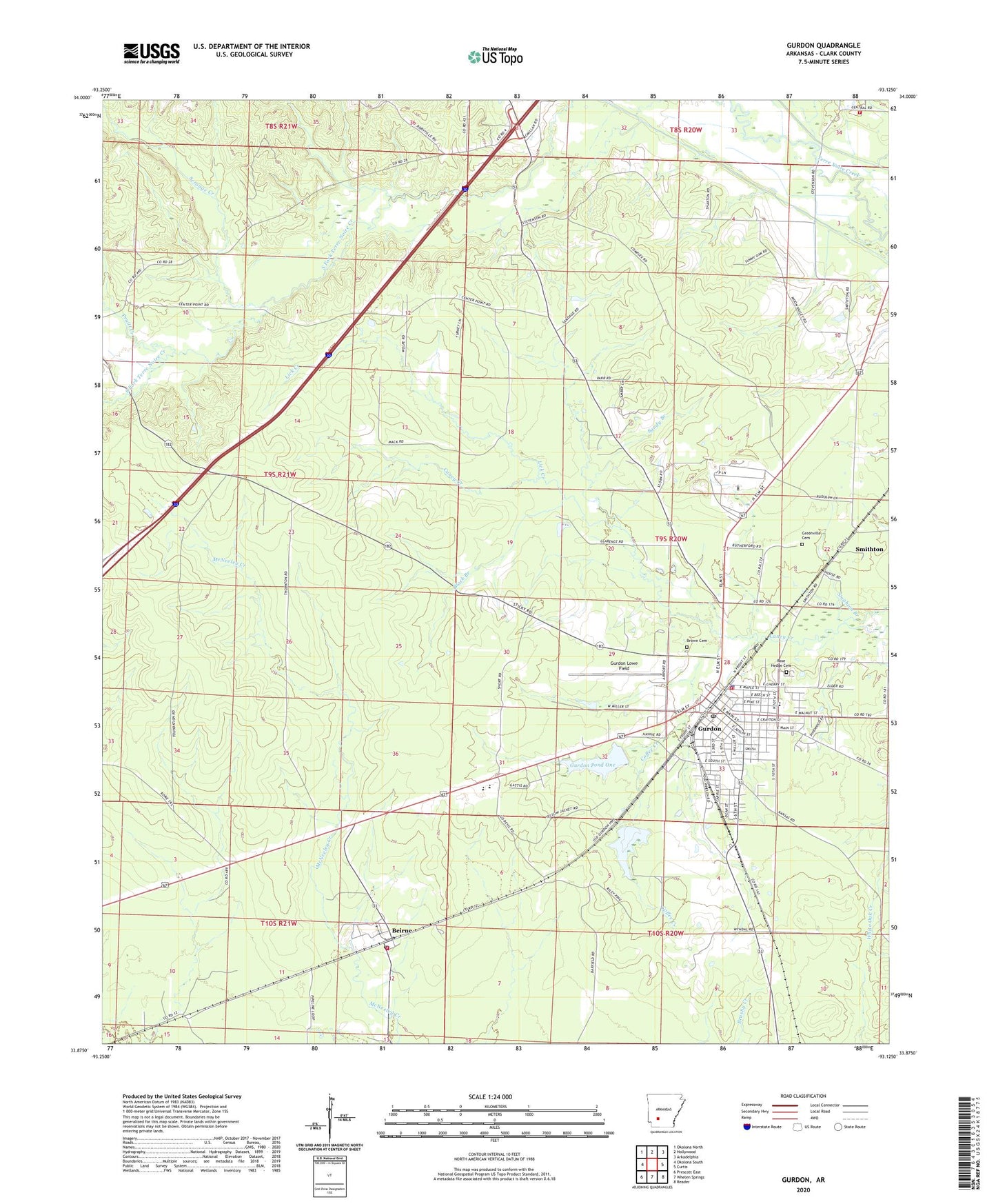
2024 topographic map quadrangle Gurdon in the state of Arkansas. Scale: 1:24000. Based on the newly updated USGS 7.5' US Topo map series, this map is in the following counties: Clark. The map contains contour data, water features, and other items you are used to seeing on USGS maps, but also has updated roads and other features. This is the next generation of topographic maps. Printed on high-quality waterproof paper with UV fade-resistant inks.
Quads adjacent to this one:
West: Okolona South
Northwest: Okolona North
North: Hollywood
Northeast: Arkadelphia
East: Curtis
Southeast: Reader
South: Whelen Springs
Southwest: Prescott East
This map covers the same area as the classic USGS quad with code o33093h2.
Contains the following named places: Beech Street Baptist Church, Beirne, Beirne Baptist Church, Beirne Census Designated Place, Beirne Post Office, Beirne Rural Volunteer Fire Department, Black Branch, Brown Cemetery, Cabe Middle School, Caney Creek, Center Grove United Methodist Church, Center Point, Center Point Baptist Church, City of Gurdon, Coffee Creek, Curtis Fire Department, Eastern Star Church, First Baptist Church, First United Methodist Church, Greenville Cemetery, Gurdon, Gurdon Fire Department, Gurdon High School, Gurdon Lowe Field, Gurdon Middle School, Gurdon Police Department, Gurdon Pond One, Gurdon Pond One Dam, Gurdon Pond Two, Gurdon Pond Two Dam, Gurdon Post Office, Gurdon Primary School, Keyton, KGAP-FM (Gurdon), Lick Creek, Mount Canaan Baptist Church, New Caney Church, New Home Church, New Ronok Church, North Boat Ditch, Pruitt Creek, Rose Hedge Cemetery, Sandy Branch, Scrouge Creek, Smithton, South Fork Baptist Church, Township of Missouri, Township of South Fork, White Oak Creek