MyTopo
Sparkman NW Arkansas US Topo Map
Couldn't load pickup availability
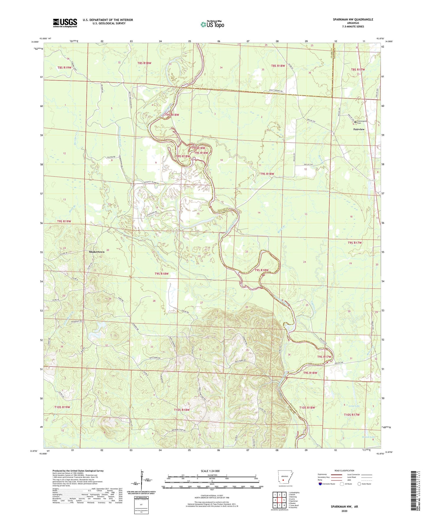
2024 topographic map quadrangle Sparkman NW in the state of Arkansas. Scale: 1:24000. Based on the newly updated USGS 7.5' US Topo map series, this map is in the following counties: Clark, Dallas. The map contains contour data, water features, and other items you are used to seeing on USGS maps, but also has updated roads and other features. This is the next generation of topographic maps. Printed on high-quality waterproof paper with UV fade-resistant inks.
Quads adjacent to this one:
West: Curtis
Northwest: Arkadelphia
North: Dalark
Northeast: Manning
East: Sparkman
Southeast: Ouachita
South: Tates Bluff
Southwest: Reader
This map covers the same area as the classic USGS quad with code o33092h8.
Contains the following named places: Beach Branch, Black Branch, Casa Massa Creek, Centerpoint Cemetery, Centerpoint Church, Cypress Creek, Deceiper Creek, Fairview, Hebron, Jackson, Long Lake, Nix Ferry, Rock Springs Church, Round Lake, Shakertown, Township of Anderson, Union Grove Church, White Oak Slough