MyTopo
Aubrey Arkansas US Topo Map
Couldn't load pickup availability
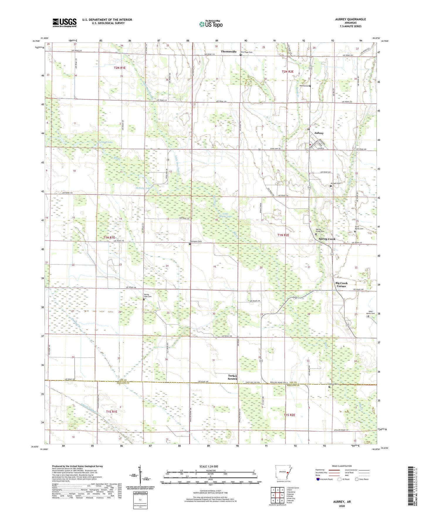
2024 topographic map quadrangle Aubrey in the state of Arkansas. Scale: 1:24000. Based on the newly updated USGS 7.5' US Topo map series, this map is in the following counties: Lee, Phillips. The map contains contour data, water features, and other items you are used to seeing on USGS maps, but also has updated roads and other features. This is the next generation of topographic maps. Printed on high-quality waterproof paper with UV fade-resistant inks.
Quads adjacent to this one:
West: Monroe
Northwest: Garrett Grove
North: Moro
Northeast: Marianna
East: Rondo
Southeast: Lexa
South: Marvell
Southwest: Pine City
This map covers the same area as the classic USGS quad with code o34090f8.
Contains the following named places: Antioch Cemetery, Aubrey, Aubrey Post Office, Aubrey Rural Volunteer Fire Station, Aubrey School, Big Creek Corner, Cat Creek, County Line Church, Holland Cemetery, Lee County Church, Little Hog Tusk Creek, Little Mossy Lake, McCloud Lake, McNulty Lake, New Hope, New Hope Cemetery, New Hope Missionary Baptist Church, Newsom School, Piney Creek, Piney Fork Lake, Saint Luke Church, Saint Marks Cemetery, Saint Marks Church, Spring Creek, Spring Creek Cemetery, Spring Lake Cemetery, Spring Lake Church, Thomasville, Thompson Cemetery, Town of Aubrey, Township of Big Creek, Township of Spring Creek, Turkey Scratch, Wilson Cemetery, ZIP Code: 72311