MyTopo
Moro Arkansas US Topo Map
Couldn't load pickup availability
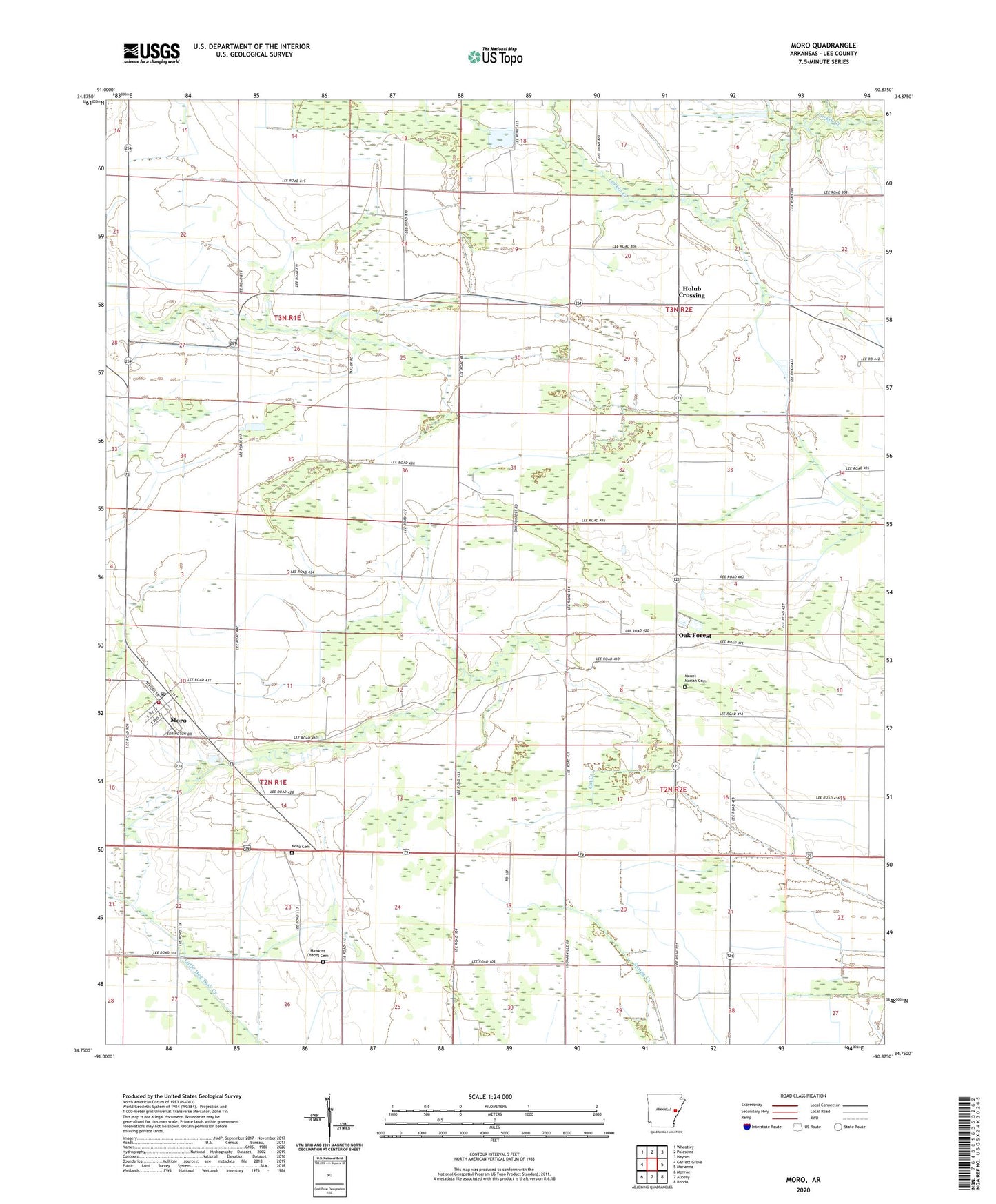
2024 topographic map quadrangle Moro in the state of Arkansas. Scale: 1:24000. Based on the newly updated USGS 7.5' US Topo map series, this map is in the following counties: Lee. The map contains contour data, water features, and other items you are used to seeing on USGS maps, but also has updated roads and other features. This is the next generation of topographic maps. Printed on high-quality waterproof paper with UV fade-resistant inks.
Quads adjacent to this one:
West: Garrett Grove
Northwest: Wheatley
North: Palestine
Northeast: Haynes
East: Marianna
Southeast: Rondo
South: Aubrey
Southwest: Monroe
This map covers the same area as the classic USGS quad with code o34090g8.
Contains the following named places: Carver School, Freedonia Church, Hawkins Chapel, Hawkins Chapel Cemetery, Holly Grove Church, Holub Crossing, KBFC-FM (Forrest City), Lee Chapel, Moro, Moro Elementary School, Moro Fire Department, Moro Post Office, Mount Gallard Church, Mount Moriah Baptist Church, Mount Moriah Cemetery, Mount Moriah School, Oak Forest, Oak Forest School, Oak Grove Cemetery, Scruggs Chapel, Smith Corner, South Plains, South Plains School, Town of Moro, Township of Oak Forest, Walls Chapel Baptist Church, Walls School