MyTopo
Rondo Arkansas US Topo Map
Couldn't load pickup availability
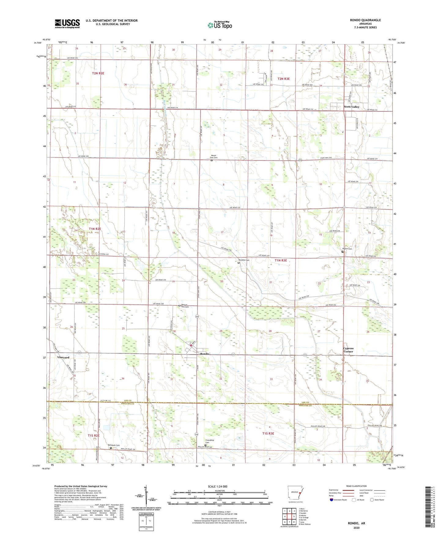
2024 topographic map quadrangle Rondo in the state of Arkansas. Scale: 1:24000. Based on the newly updated USGS 7.5' US Topo map series, this map is in the following counties: Lee, Phillips. The map contains contour data, water features, and other items you are used to seeing on USGS maps, but also has updated roads and other features. This is the next generation of topographic maps. Printed on high-quality waterproof paper with UV fade-resistant inks.
Quads adjacent to this one:
West: Aubrey
Northwest: Moro
North: Marianna
Northeast: Soudan
East: La Grange
Southeast: West Helena
South: Lexa
Southwest: Marvell
This map covers the same area as the classic USGS quad with code o34090f7.
Contains the following named places: Big Cypress Creek, Calvary Church, Chappelle, Cypress Corner, Edgewood, First Friendship Baptist Church, Friendship Cemetery, Friendship Church, KZOT-AM (Marianna), Mount Sinai Church, Mount Zion Cemetery, Mount Zion Church, New Life Church, Paradise Cemetery, Paradise Church, Pilgrim Cemetery, Pilgrim Church, Pilgrim School, Possum Trot Cemetery, Rehoboth Cemetery, Rehoboth Church, Rondo, Rondo Fire Station, Rondo School, Saint Holmes Church, Scott Valley, Scott Valley Church, Scott Valley School, Sequell Church, Third Zion Church, Town of Rondo, Township of Richland, Tyner, University of Arkansas Cotton Branch Experiment Station, Vineyard