MyTopo
Lexa Arkansas US Topo Map
Couldn't load pickup availability
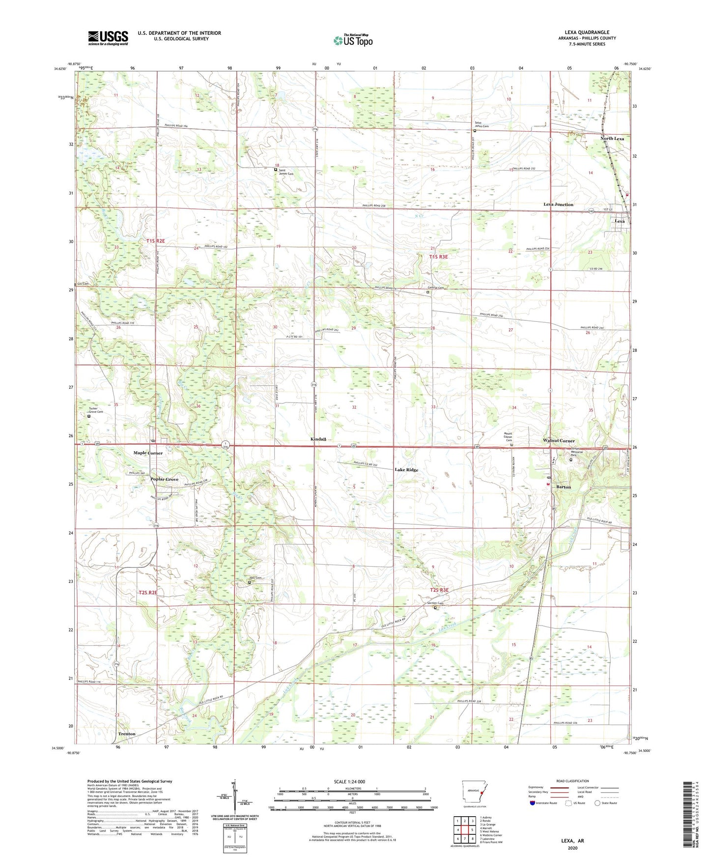
2024 topographic map quadrangle Lexa in the state of Arkansas. Scale: 1:24000. Based on the newly updated USGS 7.5' US Topo map series, this map is in the following counties: Phillips. The map contains contour data, water features, and other items you are used to seeing on USGS maps, but also has updated roads and other features. This is the next generation of topographic maps. Printed on high-quality waterproof paper with UV fade-resistant inks.
Quads adjacent to this one:
West: Marvell
Northwest: Aubrey
North: Rondo
Northeast: La Grange
East: West Helena
Southeast: Friars Point NW
South: Lakeview
Southwest: Watkins Corner
This map covers the same area as the classic USGS quad with code o34090e7.
Contains the following named places: Barton, Barton - Lexa Elementary School, Barton - Lexa High School, Barton Baptist Church, Barton Post Office, Barton Rural Fire Station, Beulah Church, Blackfoot, Blackfoot Church, Calvary Church, Central Cemetery, Crooked Creek, Harbis, Hell Cemetery, Kindall, Lake Ridge, Lexa, Lexa Junction, Lexa Rural Volunteer Fire Department, Maple Corner, Moores Chapel, Mount Gilean Cemetery, Mount Gilean Church, North Creek, North Lexa, Poplar Grove, Poplar Grove Census Designated Place, Poplar Grove Post Office, Primitive Church, Saint James Cemetery, Saint Johns Cemetery, Saint Johns Church, Saint Peters Church, Section Cemetery, Star of Bethlehem Church, Sunset Memorial Park, Town of Lexa, Township of Marion, Township of Spring Creek, Tucker Grove Cemetery, Tucker Grove Church, Walnut Corner, ZIP Code: 72374