MyTopo
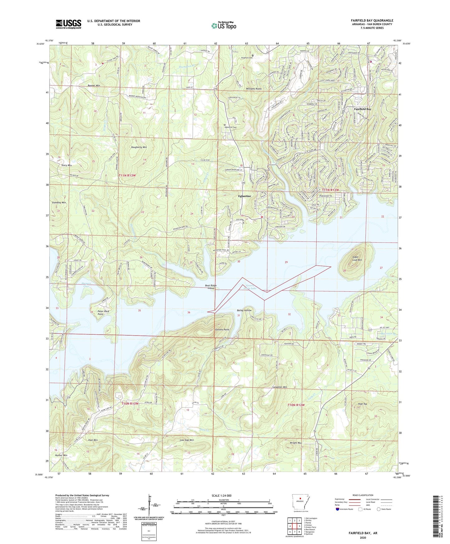
Fairfield Bay Arkansas US Topo Map
Couldn't load pickup availability
2024 topographic map quadrangle Fairfield Bay in the state of Arkansas. Scale: 1:24000. Based on the newly updated USGS 7.5' US Topo map series, this map is in the following counties: Van Buren. The map contains contour data, water features, and other items you are used to seeing on USGS maps, but also has updated roads and other features. This is the next generation of topographic maps. Printed on high-quality waterproof paper with UV fade-resistant inks.
Quads adjacent to this one:
West: Clinton
Northwest: Old Lexington
North: Shirley
Northeast: Parma
East: Greers Ferry
Southeast: Quitman
South: Morganton
Southwest: Bee Branch
This map covers the same area as the classic USGS quad with code o35092e3.
Contains the following named places: Bailey Hollow, Banner Mountain, Bloomington, Boat Ridge Island, Bradford Cemetery, Burnt Ridge Fire Station Banner Mountain, Choctaw Creek, Choctaw Pines, City of Fairfield Bay, Clinton Waterworks, Dave Creek, Dougherty Mountain, Eglantine, Eglantine Cemetery, Fairfield Bay, Fairfield Bay EMS, Fairfield Bay Marina, Fairfield Bay Police Department, Fairfield Bay Volunteer Fire Department Station 1, Fairfield Bay Volunteer Fire Department Station 2, Green Creek, Harpers Cove, High Top, Hooten Hollow, Hunter Mountain, Lazy Creek, Lewallen Mountain, Low Gap Mountain, Lynn Creek, Moccasin Branch, Palisades, Peter Rock Point, Pine Grove Church, Pleasant Valley Church, South Fork Recreation Area, Standley Church, Stevens Point, Sugar Loaf Mountain, Sugar Loaf Recreation Area, Thompson Creek, Township of Davis, Township of Indian Rock, Township of Red River, Township of Sulphur Springs, United Methodist Church, Van Buren Recreation Area, Wild Goose Branch, Williams Rocks, Wright Mountain, ZIP Code: 72088