MyTopo
McCrory Arkansas US Topo Map
Couldn't load pickup availability
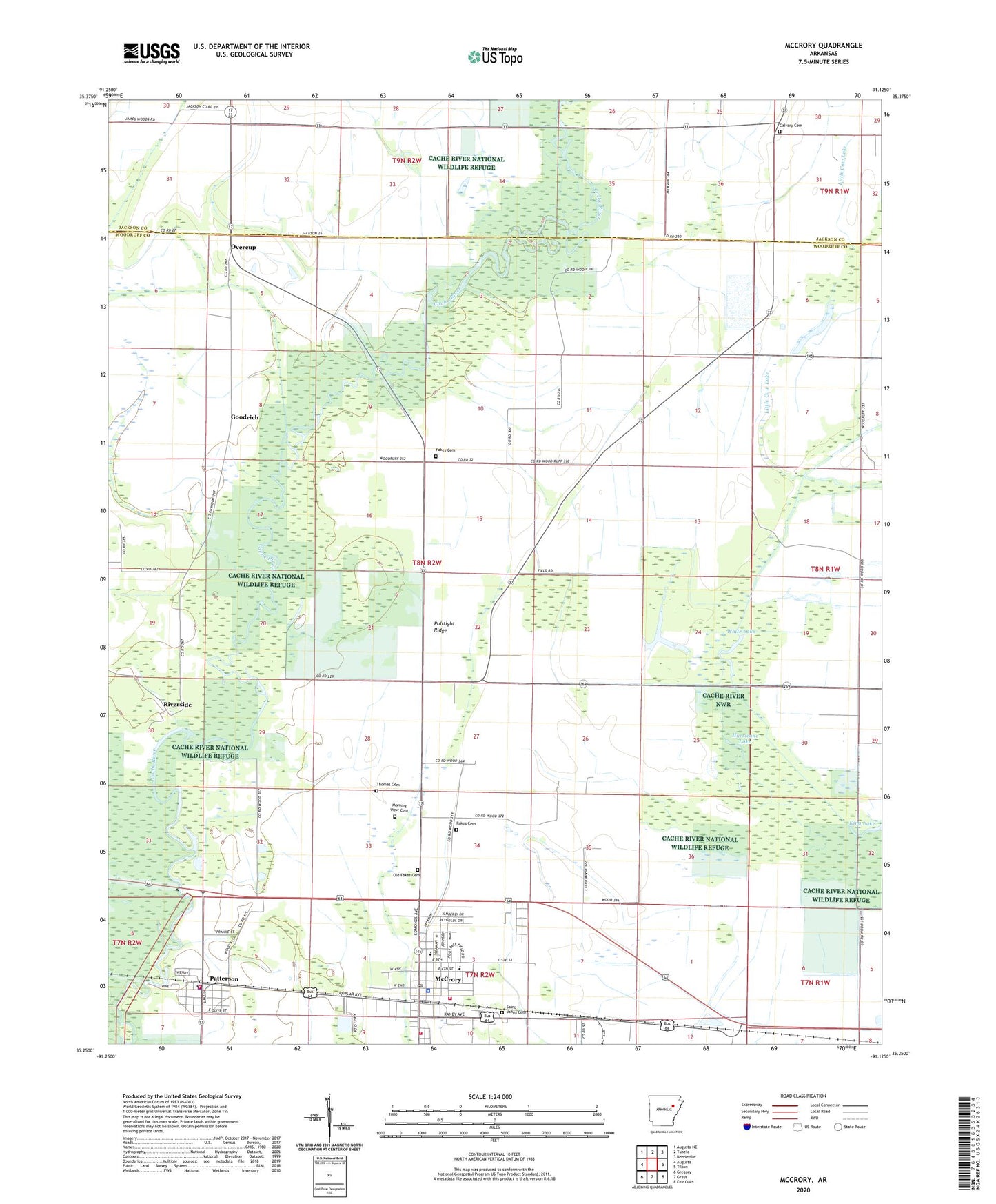
2024 topographic map quadrangle McCrory in the state of Arkansas. Scale: 1:24000. Based on the newly updated USGS 7.5' US Topo map series, this map is in the following counties: Woodruff, Jackson. The map contains contour data, water features, and other items you are used to seeing on USGS maps, but also has updated roads and other features. This is the next generation of topographic maps. Printed on high-quality waterproof paper with UV fade-resistant inks.
Quads adjacent to this one:
West: Augusta
Northwest: Augusta NE
North: Tupelo
Northeast: Beedeville
East: Tilton
Southeast: Fair Oaks
South: Grays
Southwest: Gregory
This map covers the same area as the classic USGS quad with code o35091c2.
Contains the following named places: Bell Grove School, Calvary Cemetery, Calvary Church, City of McCrory, City of Patterson, Fakes Cemetery, Fakes Chapel, Fakes Chapel Cemetery, Goodrich, Goodrich Chapel, Hurricane Lake, King Lake, Little Cow Lake, Mc Crory Elementary School, Mc Crory High School, McCrory, McCrory Commercial Historic District, McCrory Fire Department Station 1, Mccrory Fire Department Station 2, McCrory Police Department, McCrory Post Office, McDonald Church, Morning View Cemetery, Morning View Church, Old Channel Bayou De View, Old Fakes Cemetery, Overcup, Patterson, Patterson Police Department, Patterson Post Office, Patterson Volunteer Fire Station, Pulltight Ridge, Riverside, Saint Johns Cemetery, Simmons, Sturdevant, Taylorville, Thomas Cemetery, Township of Barnes, White Lake, Woodruff County Ambulance Service, Woodruff County Hospital, Woodruff County Hospital and Nursing Home Heliport, ZIP Code: 72123