MyTopo
Tupelo Arkansas US Topo Map
Couldn't load pickup availability
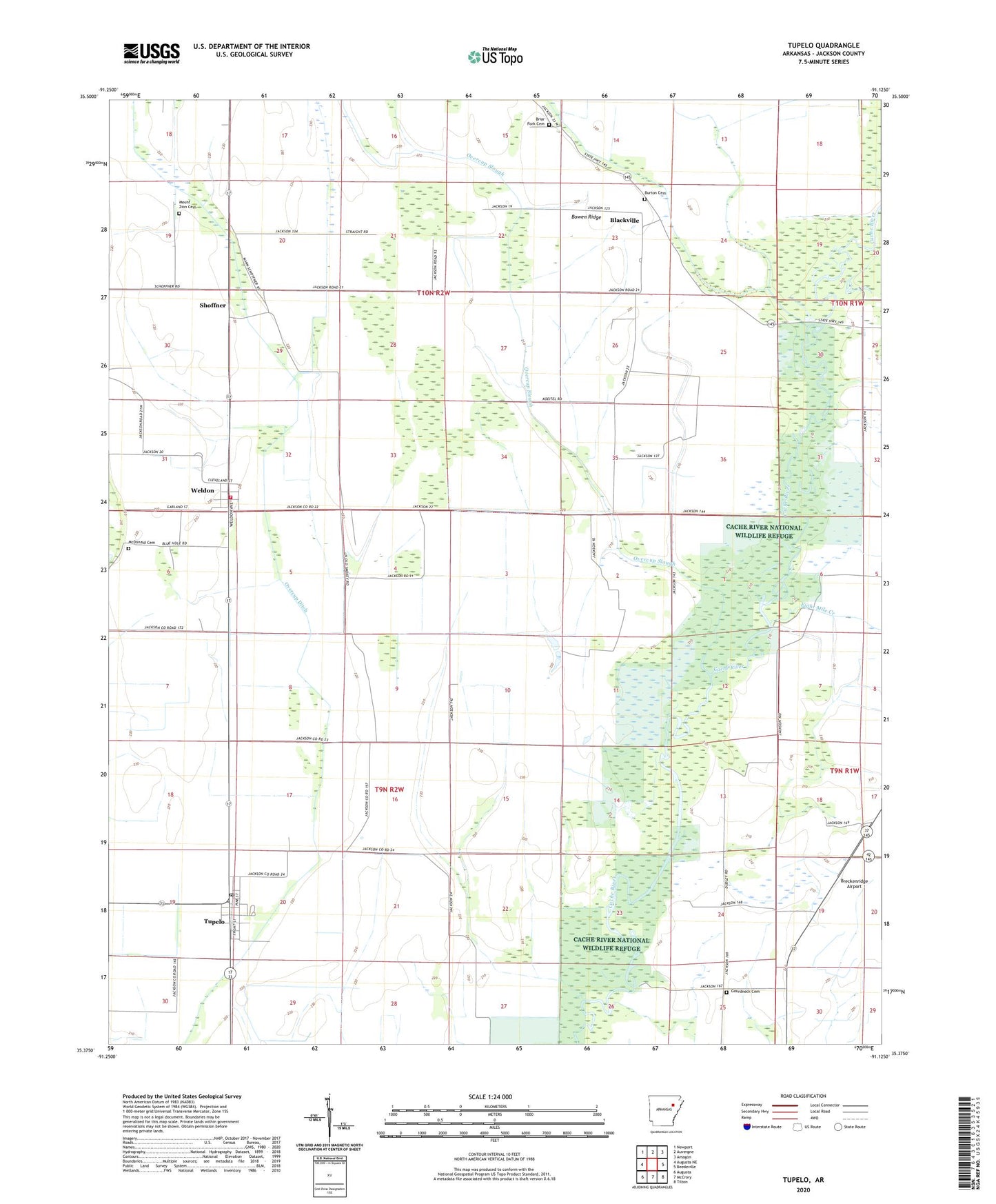
2024 topographic map quadrangle Tupelo in the state of Arkansas. Scale: 1:24000. Based on the newly updated USGS 7.5' US Topo map series, this map is in the following counties: Jackson. The map contains contour data, water features, and other items you are used to seeing on USGS maps, but also has updated roads and other features. This is the next generation of topographic maps. Printed on high-quality waterproof paper with UV fade-resistant inks.
Quads adjacent to this one:
West: Augusta NE
Northwest: Newport
North: Auvergne
Northeast: Amagon
East: Beedeville
Southeast: Tilton
South: McCrory
Southwest: Augusta
This map covers the same area as the classic USGS quad with code o35091d2.
Contains the following named places: Black Landing Field, Blacksville School, Blackville, Bowen Ridge, Breckenridge Airport, Briar Fork Cemetery, Briar Fork Church, Burton Cemetery, Eight Mile Creek, Gourd Neck, Gourd Neck School, Gourdneck Cemetery, Livesay Landing Strip, Maple Chapel, McDonald Cemetery, Mount Pleasant Church, Mount Zion Cemetery, Mount Zion Church, Overcup Ditch, Overcup Slough, Pleasant Briar Fork Church, Shoffner, Town of Tupelo, Town of Weldon, Township of Breckenridge, Tupelo, Tupelo Post Office, Weldon, Weldon School, Weldon Volunteer Fire Department, ZIP Code: 72169