MyTopo
Boswell Arkansas US Topo Map
Couldn't load pickup availability
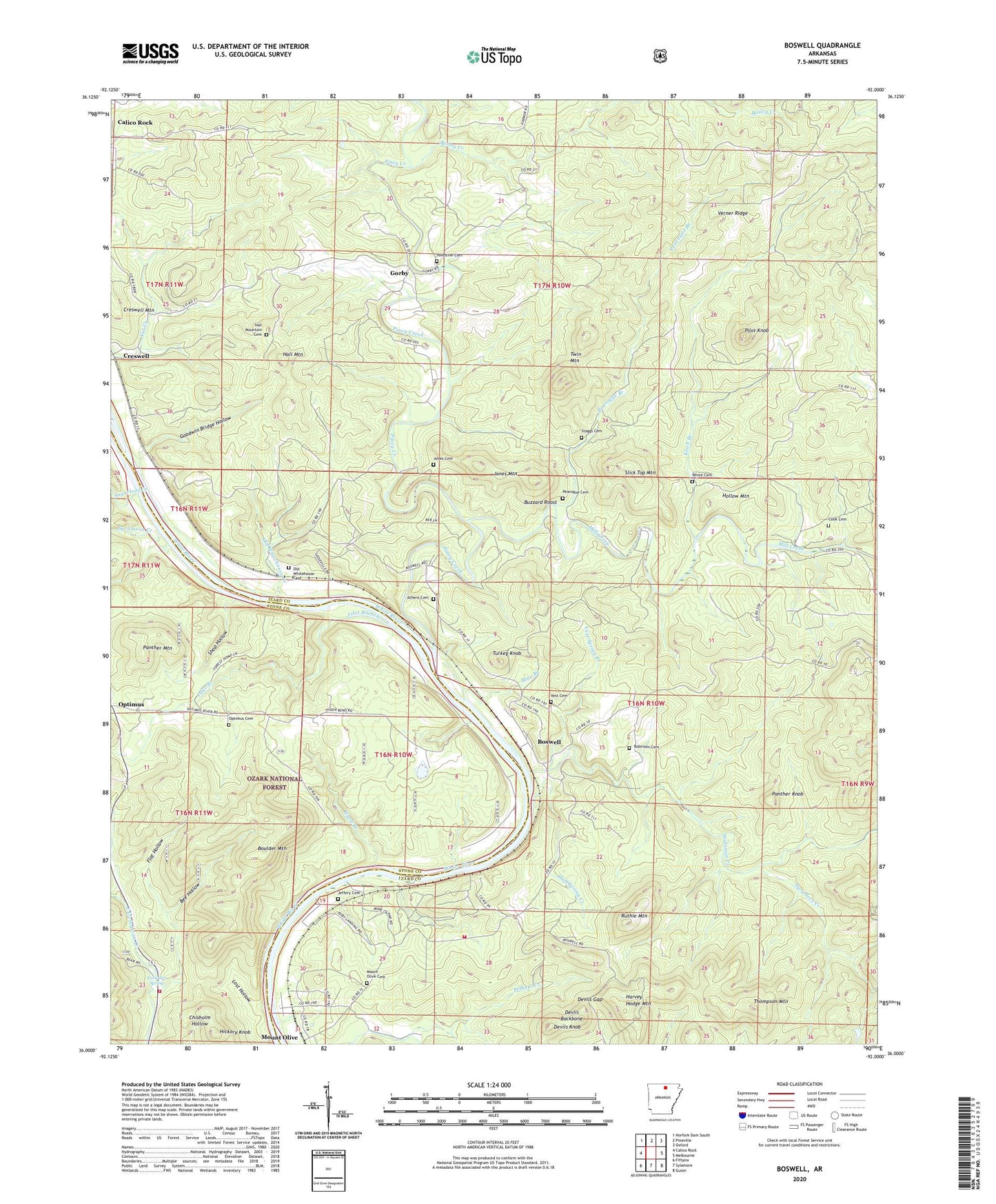
2024 topographic map quadrangle Boswell in the state of Arkansas. Scale: 1:24000. Based on the newly updated USGS 7.5' US Topo map series, this map is in the following counties: Izard, Stone. The map contains contour data, water features, and other items you are used to seeing on USGS maps, but also has updated roads and other features. This is the next generation of topographic maps. Printed on high-quality waterproof paper with UV fade-resistant inks.
Quads adjacent to this one:
West: Calico Rock
Northwest: Norfork Dam South
North: Pineville
Northeast: Oxford
East: Melbourne
Southeast: Guion
South: Sylamore
Southwest: Fiftysix
This map covers the same area as the classic USGS quad with code o36092a1.
Contains the following named places: Allison - Sylamore Volunteer Fire Station 5, Athens Cemetery, Bailey Creek, Bearhead Branch, Bee Hollow, Blue Branch, Bone Island, Boswell, Boswell Baptist Church, Boulder Mountain, Buzzard Roost, Cook Cemetery, Creswell, Devils Backbone, Devils Gap, Devils Knob, Flat Hollow, Goodwin Bridge Hollow, Gorby, Hall Mountain, Hall Mountain Cemetery, Harvey Hodge Mountain, Hickory Knob, Hollow Mountain, Huff Spring Creek, Islet Branch, Jeffery Cemetery, Jones Cemetery, Jones Mountain, Knob Branch, Lost Hollow, Mill Creek, Mount Joy Church, Mount Olive, Mount Olive Cemetery, Mount Olive Census Designated Place, Old Whitehouse Cemetery, Old Whitehouse Creek, Optimus Cemetery, Palestine Cemetery, Panther Knob, Panther Mountain, Pearogue Branch, Pearogue Cemetery, Pilot Knob, Piney Creek, Robinson Cemetery, Ruthie Mountain, Ruthie Mountain Volunteer Fire Department, Shop Hollow, Slick Top Mountain, Staggs Cemetery, Sugarloaf Creek, Sycamore Creek, Tarwater Spring, Thompson Mountain, Township of Athens, Township of Claiborne, Township of Mount Olive, Turkey Knob, Twin Mountain, Verner Ridge, Vest, Vest Cemetery, Vest Spring Branch, Ward Branch, White Cemetery, Wideman Creek