MyTopo
Oxford Arkansas US Topo Map
Couldn't load pickup availability
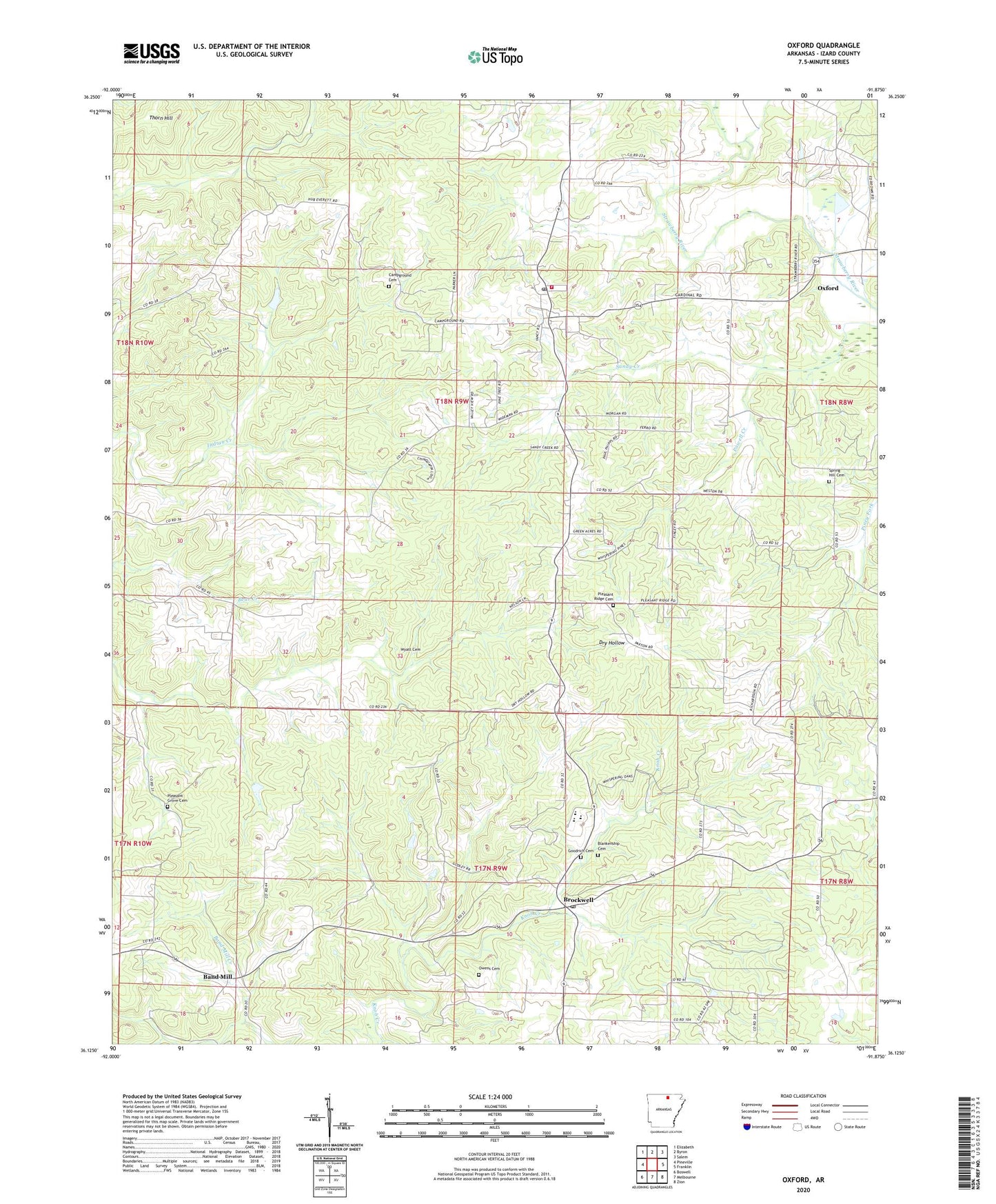
2024 topographic map quadrangle Oxford in the state of Arkansas. Scale: 1:24000. Based on the newly updated USGS 7.5' US Topo map series, this map is in the following counties: Izard. The map contains contour data, water features, and other items you are used to seeing on USGS maps, but also has updated roads and other features. This is the next generation of topographic maps. Printed on high-quality waterproof paper with UV fade-resistant inks.
Quads adjacent to this one:
West: Pineville
Northwest: Elizabeth
North: Byron
Northeast: Salem
East: Franklin
Southeast: Zion
South: Melbourne
Southwest: Boswell
This map covers the same area as the classic USGS quad with code o36091b8.
Contains the following named places: Band Mill, Blankenship Cemetery, Brockwell, Brockwell Post Office, Campground Cemetery, Chapel Hill Church, Christian Chapel, City of Oxford, Goodrich Cemetery, Izard County Consolidated Elementary School, Izard County Consolidated High School, Izard County Consolidated Middle School, Jett, Liberty Hill Church, Owens Cemetery, Oxford, Oxford Baptist Church, Oxford Lookout Tower, Oxford Post Office, Oxford United Methodist Church, Oxford Volunteer Fire Department, Pleasant Grove Cemetery, Pleasant Grove Church, Pleasant Ridge Cemetery, Pleasant Ridge Church, Powell Creek, Spring Hill Cemetery, Spring Hill Church, Thorn Hill, Township of New Hope, Township of Newburg, Twin Bridges, Wyatt Cemetery, ZIP Codes: 72517, 72565