MyTopo
Pineville Arkansas US Topo Map
Couldn't load pickup availability
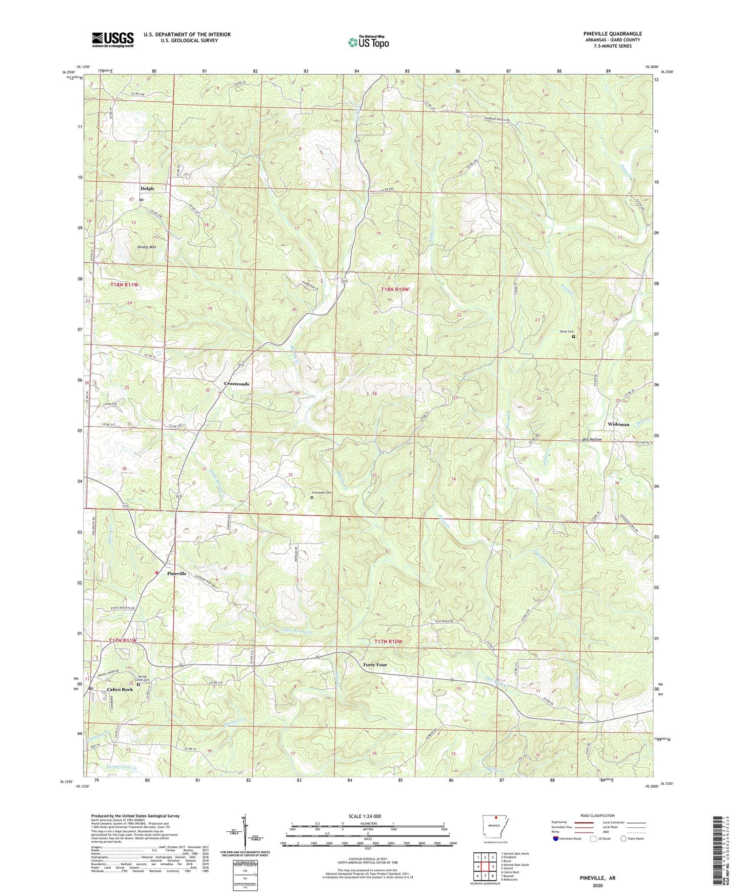
2024 topographic map quadrangle Pineville in the state of Arkansas. Scale: 1:24000. Based on the newly updated USGS 7.5' US Topo map series, this map is in the following counties: Izard. The map contains contour data, water features, and other items you are used to seeing on USGS maps, but also has updated roads and other features. This is the next generation of topographic maps. Printed on high-quality waterproof paper with UV fade-resistant inks.
Quads adjacent to this one:
West: Norfork Dam South
Northwest: Norfork Dam North
North: Elizabeth
Northeast: Byron
East: Oxford
Southeast: Melbourne
South: Boswell
Southwest: Calico Rock
This map covers the same area as the classic USGS quad with code o36092b1.
Contains the following named places: Bear Creek, Brushy Creek, Calico Rock Post Office, Campgrounds Church, City of Calico Rock, Corinth Church, Cresswell Cemetery, Crossroads, Dolph, Dolph Post Office, Dry Hollow, Flat Rock Church, Flat Rock Creek, Forty Four, Hively Mountain, Huron, Indian Creek, Little Brushy Creek, Little Creek, Nasty Creek, Pineville, Pineville Cumberland Presbyterian Church, Pineville Volunteer Fire Department, Potts Cemetery, Spring Creek, Spring Creek Cemetery, Spring Creek Methodist Church, Town of Pineville, Township of Bryan, Township of Guthrie, Wideman, Wideman Post Office, ZIP Codes: 72566, 72585