MyTopo
Boyd Hill Arkansas US Topo Map
Couldn't load pickup availability
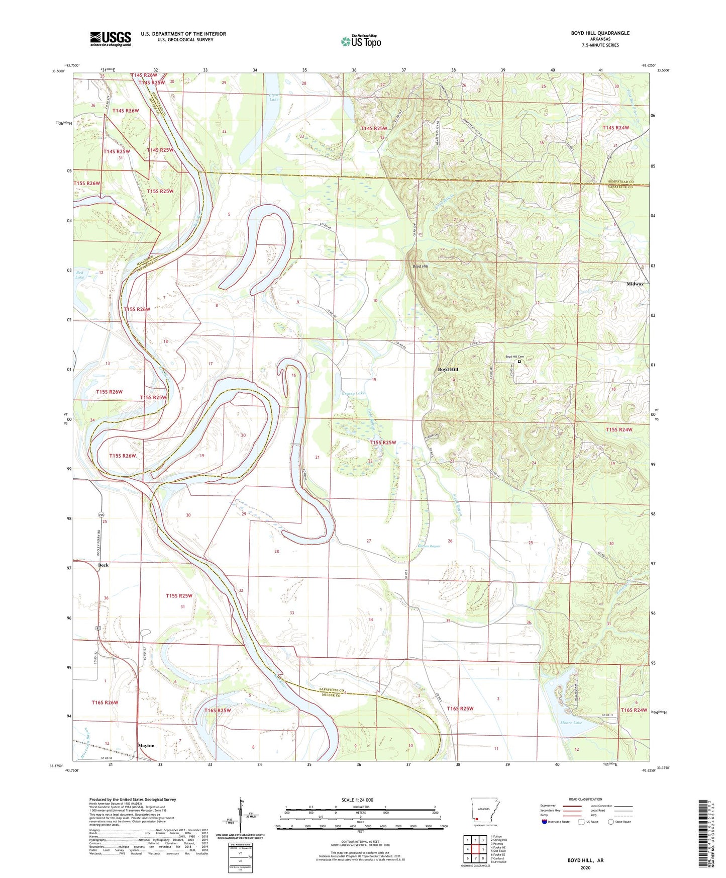
2024 topographic map quadrangle Boyd Hill in the state of Arkansas. Scale: 1:24000. Based on the newly updated USGS 7.5' US Topo map series, this map is in the following counties: Lafayette, Miller, Hempstead. The map contains contour data, water features, and other items you are used to seeing on USGS maps, but also has updated roads and other features. This is the next generation of topographic maps. Printed on high-quality waterproof paper with UV fade-resistant inks.
Quads adjacent to this one:
West: Fouke NE
Northwest: Fulton
North: Spring Hill
Northeast: Patmos
East: Old Town
Southeast: Lewisville
South: Garland
Southwest: Fouke SE
This map covers the same area as the classic USGS quad with code o33093d6.
Contains the following named places: 1927 Cut-off Lake, Beck, Bois D'Arc Creek, Boyd Hill, Boyd Hill Cemetery, Calvary Church, Clear Lake, Common Hill Church, Cypress City Lake, Galilee Church, Grassy Lake, Hurricane Hill, Kenney Creek, Kitchen Bayou, Lane Fort Church, Mays Lake, Mayton, Moore Lake, Moore Lake Dam, Red Lake, Township of Russell