MyTopo
Fulton Arkansas US Topo Map
Couldn't load pickup availability
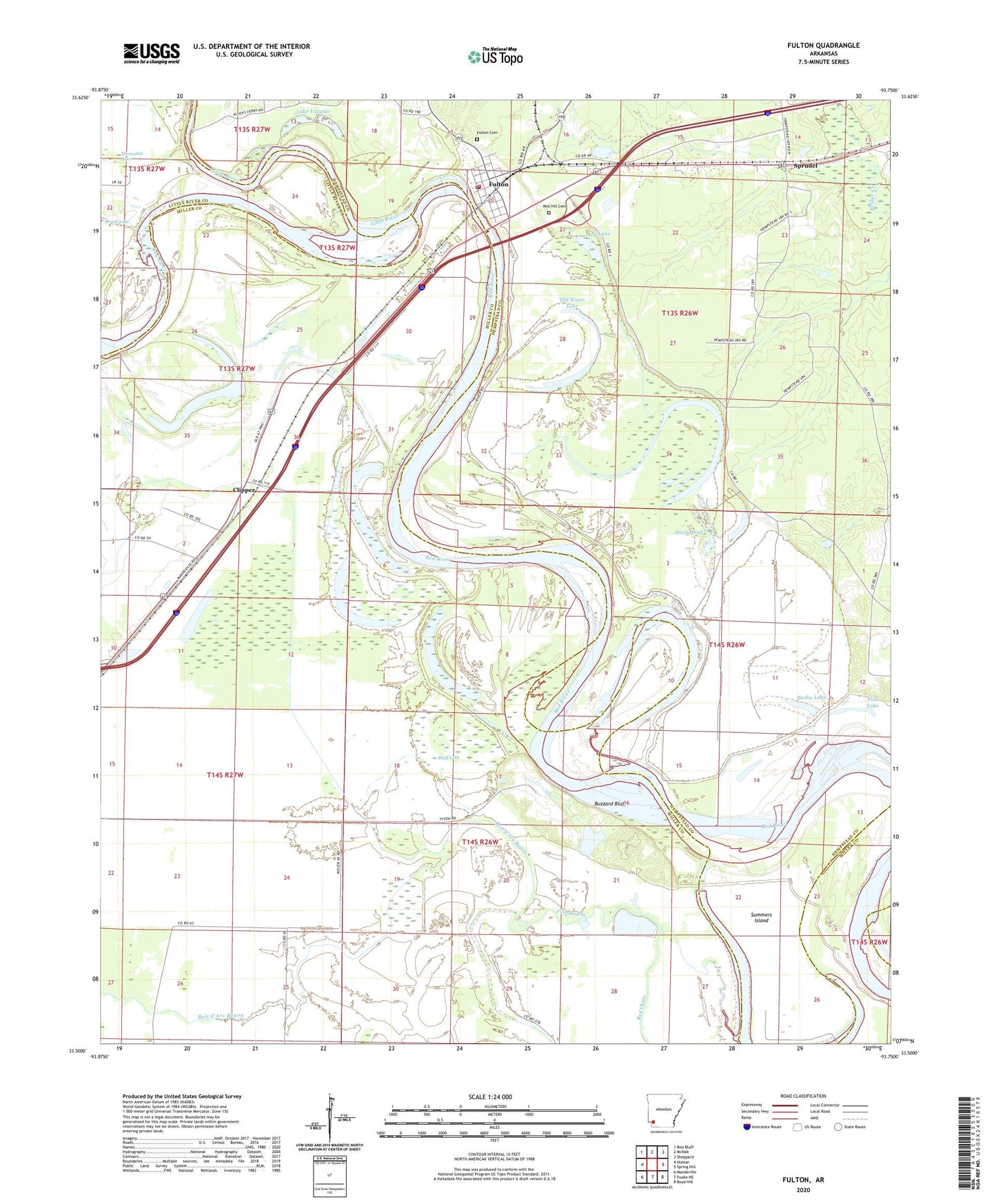
2024 topographic map quadrangle Fulton in the state of Arkansas. Scale: 1:24000. Based on the newly updated USGS 7.5' US Topo map series, this map is in the following counties: Miller, Hempstead, Little River. The map contains contour data, water features, and other items you are used to seeing on USGS maps, but also has updated roads and other features. This is the next generation of topographic maps. Printed on high-quality waterproof paper with UV fade-resistant inks.
Quads adjacent to this one:
West: Homan
Northwest: Red Bluff
North: McNab
Northeast: Sheppard
East: Spring Hill
Southeast: Boyd Hill
South: Fouke NE
Southwest: Mandeville
This map covers the same area as the classic USGS quad with code o33093e7.
Contains the following named places: Adams Cut-off Lake, Bluff Lake, Bois d'Arc Bayou, Bushy Lake, Buzzard Bluff, Charity Church, Clipper, Duck Pond, Finn Bayou, Fish Lake, Fulton, Fulton Cemetery, Fulton Post Office, Fulton Volunteer Fire Department, Galilee Church, Kuykendall Lake, Lake Vaughn, Little River, Mud Lake, Old Allens Ferry, Old River Lake, Red Hill Cemetery, Red Lake, Red Lake School, Scott Lake, Sprudel, Summers Island, Town of Fulton, Willow Lake