MyTopo
Garland Arkansas US Topo Map
Couldn't load pickup availability
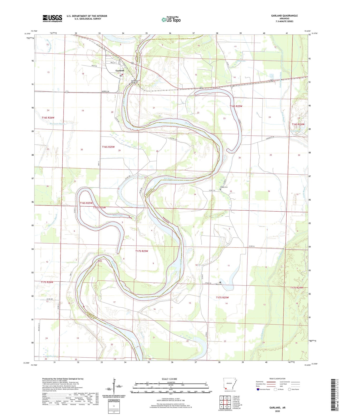
2024 topographic map quadrangle Garland in the state of Arkansas. Scale: 1:24000. Based on the newly updated USGS 7.5' US Topo map series, this map is in the following counties: Lafayette, Miller. The map contains contour data, water features, and other items you are used to seeing on USGS maps, but also has updated roads and other features. This is the next generation of topographic maps. Printed on high-quality waterproof paper with UV fade-resistant inks.
Quads adjacent to this one:
West: Fouke SE
Northwest: Fouke NE
North: Boyd Hill
Northeast: Old Town
East: Lewisville
Southeast: Bradley NE
South: Canfield
Southwest: Doddridge NE
This map covers the same area as the classic USGS quad with code o33093c6.
Contains the following named places: Battle Lake, Bill Rogers Airport, Bradley Lake, Brushy Lake, Candler Lake, Cargill Pond, Cargill Pond Dam, Cedar Grove School, Cypress Lake, Cypress Lake Oil and Gas Field, Duck Lake, Field Bayou Ditch, Garland, Garland City Fire Department, Garland City Post Office, Garland Elementary School, Garland High School, Keller Lake, Mays Cemetery, Mays Lake, New Gum Point Church, New Saint Paul Church, Old Gum Point Church, Old Saint Paul Church, Red River Bridge, Reed-Joseph Land Company Airport, Shady Grove Church, Spirit Lake, Spirit Lake Oil and Gas Field, Swan Lake, Town of Garland, Township of Steel, Wagoner School, West Tract Church, Wright Cemetery, ZIP Codes: 71839, 71845