MyTopo
Fouke NE Arkansas US Topo Map
Couldn't load pickup availability
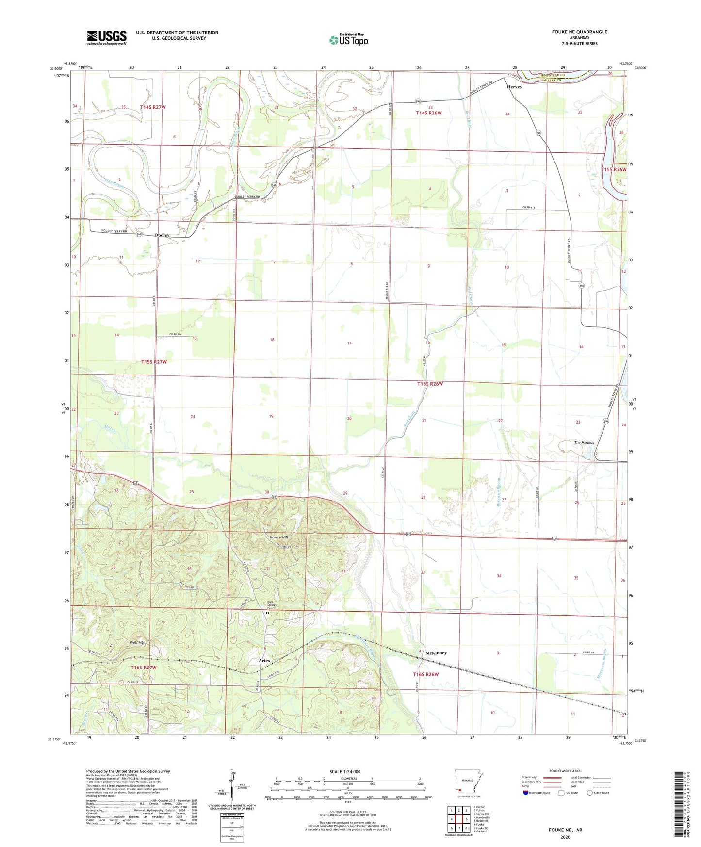
2024 topographic map quadrangle Fouke NE in the state of Arkansas. Scale: 1:24000. Based on the newly updated USGS 7.5' US Topo map series, this map is in the following counties: Miller, Hempstead. The map contains contour data, water features, and other items you are used to seeing on USGS maps, but also has updated roads and other features. This is the next generation of topographic maps. Printed on high-quality waterproof paper with UV fade-resistant inks.
Quads adjacent to this one:
West: Mandeville
Northwest: Homan
North: Fulton
Northeast: Spring Hill
East: Boyd Hill
Southeast: Garland
South: Fouke SE
Southwest: Fouke
This map covers the same area as the classic USGS quad with code o33093d7.
Contains the following named places: Artex, Coe Creek, Dooley, First Old River Lake, Garland City Oil and Gas Field, Hervey, Krause Hill, McKinney, Mill Creek, Red Chute, Rock Springs Cemetery, Second Old River Lake, The Mounds, Township of Lost Prairie, Township of Red River, Tregg Church, Troy Church, Wolf Mountain