MyTopo
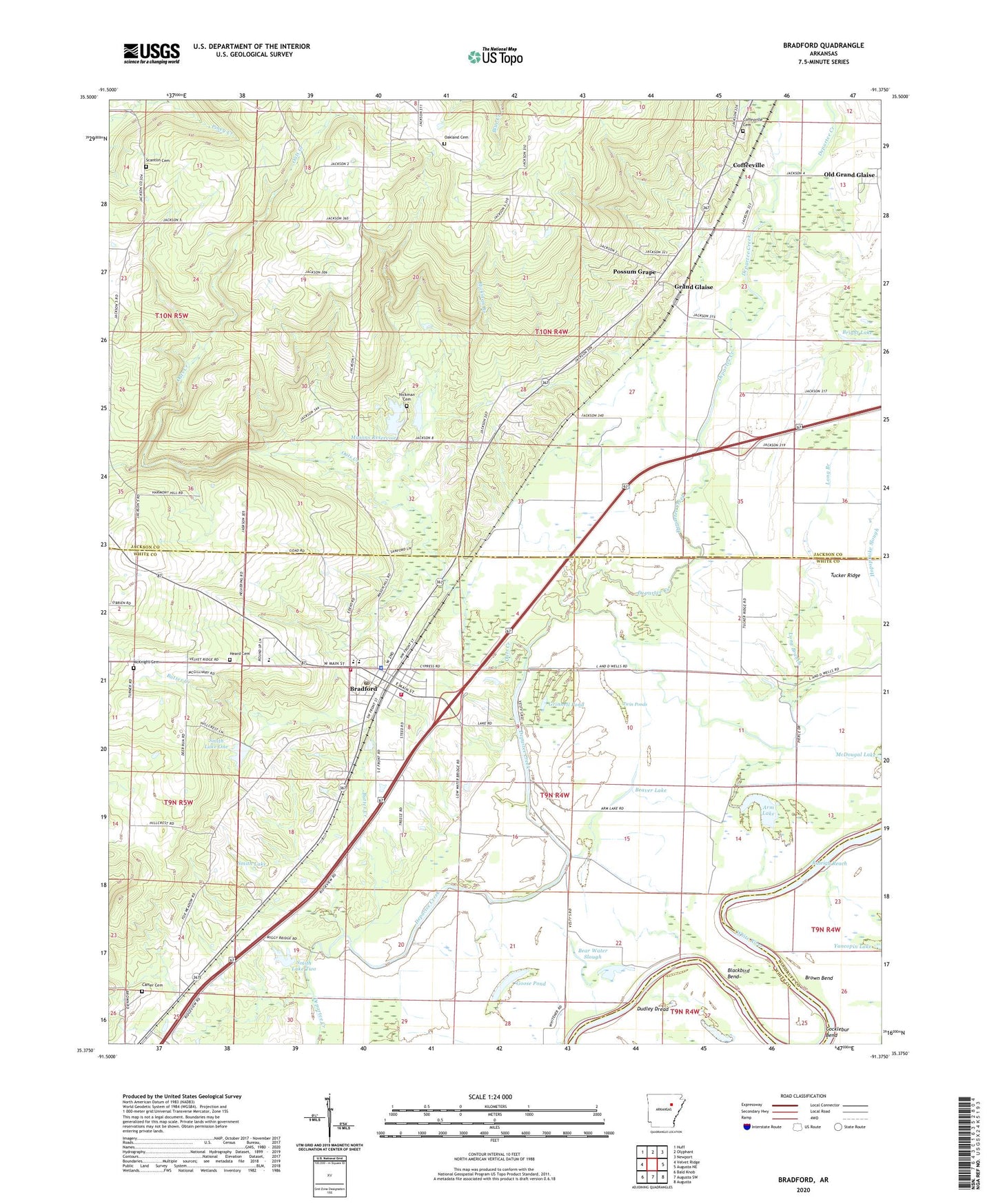
Bradford Arkansas US Topo Map
Couldn't load pickup availability
2024 topographic map quadrangle Bradford in the state of Arkansas. Scale: 1:24000. Based on the newly updated USGS 7.5' US Topo map series, this map is in the following counties: White, Jackson, Woodruff. The map contains contour data, water features, and other items you are used to seeing on USGS maps, but also has updated roads and other features. This is the next generation of topographic maps. Printed on high-quality waterproof paper with UV fade-resistant inks.
Quads adjacent to this one:
West: Velvet Ridge
Northwest: Huff
North: Olyphant
Northeast: Newport
East: Augusta NE
Southeast: Augusta
South: Augusta SW
Southwest: Bald Knob
This map covers the same area as the classic USGS quad with code o35091d4.
Contains the following named places: Arm Lake, B C Smith Lake Dam, Bear Water Slough, Beaver Lake, Blackbird Bend, Bradford, Bradford Elementary School, Bradford Fire Department Station 1, Bradford Fire Department Station 2, Bradford High School, Bradford Lake, Bradford Police Department, Bradford Post Office, Bright Lake, Brown Bend, Brushy Lake, Butter Creek, Carter Cemetery, City of Bradford, Coffeeville, Coffeyville Cemetery, Daniel Landing, Dudley Dread, Friendship Church, Goad Place, Goose Pond, Grand Glaise, Grinnell Pond, Heard Cemetery, Hickman Branch, Hickman Cemetery, Hopspinike Lake, Hopspinike Slough, Little Lake, Long Branch, Masons Reservoir, Masons Reservoir Dam, McKnight Cemetery, Mica Lake, Oakland Cemetery, Oakland Church, Oats Creek, Old Grand Glaise, Possum Grape, Raleigh Reach, Russell Place, Scantlin Cemetery, Smith Lake, Smith Lake One, Smith Lake One Dam, Smith Lake Two, Smith Lake Two Dam, Steenbergen Lake, Township of Glaize, Township of Liberty, Tucker Ridge, Twin Ponds, ZIP Code: 72020